
by Eleisha Fahy | 11 September 2025
This very pleasant, cycleable route over the western Lammermuirs entirely follows rough tracks and minor roads. All gates can be easily opened. From Longyester, head southwest by Blinkbonny Wood, where the road becomes a rough track and continue up to the east...
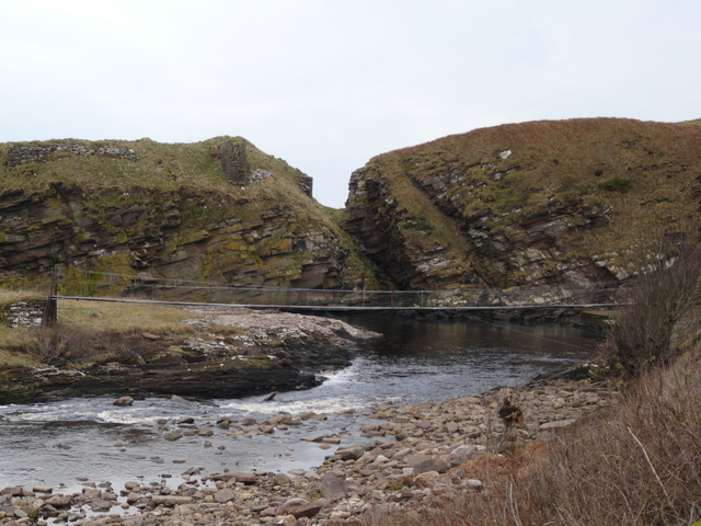
by David Oxley | 11 September 2025
The former salmon fishing station is most easily accessed along Mill Road then by a footbridge across the Berriedale Water. An older track descends to the shore from the Berriedale Brae hairpin to the north, but this isn't as readily accessible, the A9 being...

by David Oxley | 11 September 2025
If the route is done south to north there are no real route finding issues* beyond crossing the boggy section and heading into the trees from the south side of Mannoch Hill. If the route is done north to south then there is an unclear cutoff of the track on Mannoch...
by Eleisha Fahy | 11 September 2025
From Eaglesham, although the historic line goes more or less directly south towards Carrot, the most straightforwardly accessible way is to instead take the road southeast towards Ardoch Burn. Just before the bridge, turn right (southwest) to go by Over Enoch towards...

by Neil Birch | 11 September 2025
From Dunbar, a direct route by road runs by Spott and Spott Mill to Halls (NT652727). However, if walking or cycling, the Spott Road’s roundabout junction with the A1 is best avoided. Instead, the following approach is suggested – head southeast out of...