The Weavers Trail Show path on map
Start location: Montgomery Square, Eaglesham ( NS 573 519 )
End location: Darvel ( NS 565 374 )
Geographical area: Strathclyde and Lanarkshire
Path type: Trade Route
Path distance: 18km
Accessibility info: Suitable for pedestrians
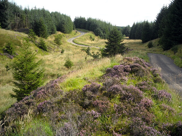
Route Description
From Eaglesham, although the historic line goes more or less directly south towards Carrot, the most straightforwardly accessible way is to instead take the road southeast towards Ardoch Burn. Just before the bridge, turn right (southwest) to go by Over Enoch towards Carrot.
At NS576482, before reaching Carrot, a track goes southwest and into the forest. Follow this track for around 1.5km to a crossroads (NS568471) about 800m north of Carrot Moor Farm (Myres on older maps). Here, there is a diversion available to avoid cattle – turn right (west) and follow the track which turns south-southwest to reach a faint, overgrown path which joins the access road approaching the southern side of Carrot Moor Farm. Turn left along this, and when the track curves northeast heading towards buildings at the farm, instead follow a track on the right that ends after a short distance in a small quarry area. From here, head southeast over very rough pathless ground to gain a windfarm access road near Turbine 48; follow this access road southeast to Turbine 61. From here the route heads south across an area of felled forestry towards the windfarm’s main Spine Road. At first sight the felled area looks impassable, but about 50m beyond Turbine 61 there is a gap in the bushes. Head 20-30m into the felled area to find a former forest ride with a faint, narrow path along it. Cross over the Spine Road and continue straight ahead on a narrow path through felled forestry towards High Overmuir. From there head south by the east edge of the forest to join the minor road at Longgreen, 4km by road from Darvel.
The Heritage Paths project has received reports that the section of the route between Myres Hill and High Overmuir is unclear, in part because of the Whitelee Windfarm which now lies across the route. It is our understanding from the Councils’ access teams that it is intended that the route be improved and sign-posted. However, landowner negotiations and forestry operations can be a time-consuming process. In the meantime, we would be very grateful for a survey from anyone who walks the route – useful background for route planning may be Kenneth Mallard’s 2009 Geograph article.
OS Landranger 64 (Glasgow) & 71 (Lanark & Upper Nithsdale)
Heritage Information
The Irvine Valley towns of Darvel and Newmilns were world famous in the manufacture of lace products. Darvel's last lace factory closed as recently as 2008, while there are still two factories operating in Newmilns. Before the factory system was introduced with the advent of the power loom in 1872, lace was produced on handlooms in hundreds of cottages in the Valley. The handloom weavers in the days of this domestic system of manufacture walked over the moor with their rolls of cloth to sell them in the markets of Paisley and Glasgow - hence the name The Weavers Trail.
Eaglesham too was known for weaving. The New Statistical Account (1834-1845) reported that the 63 silk-looms of 1790 had been entirely replaced by the weaving of cotton.
John Ainslie's Map of the County of Renfrew (1800) shows this route from Eaglesham to the county boundary southeast of Myres. A route across the moors is shown on the first edition of the Ordnance Survey 6" maps. This line alters relatively little in subsequent editions, until the advent of forestry over the southern half of the route. The original line of the right of way appears to have been overplanted and so this section has migrated to the east.
Eaglesham Moor was the subject of BBC Radio 4's Open Country in December 2016. The programme opens with Whitelee Ranger, Rennie Mason, talking about the Weavers Trail - he has some great stories and they're not even all about weaving! It's well worth a listen.