Tramps, hawkers, thieves – their journeying has featured in many old songs, and these days I guess we could add baggers to the list. It was Munro-bagging that first led me to one of the longest and finest of the ScotWays Heritage Paths: the 70+ km Thieves’ Road from Dalwhinnie to Fort William.
We were a party of five, years ago, on a trip with the Scottish walking experts C-N-Do to the six Munros round Ben Alder. Setting off from Dalwhinnie,* none of us knew that we were walking on the Thieves’ Road. It got its name centuries ago, when lawless Badenoch and Strathspey were thieves’ hunting grounds, and it offered a direct way to Lochaber, apparently a good place to find buyers for the loot. You can learn more about the route on Heritage Paths.
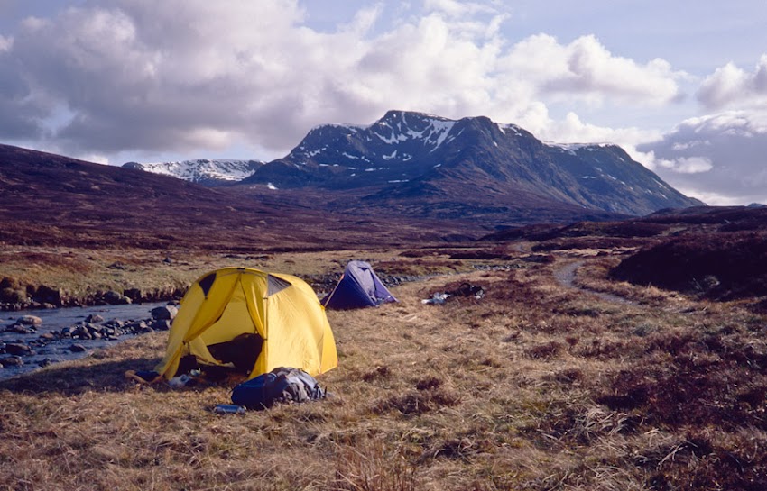
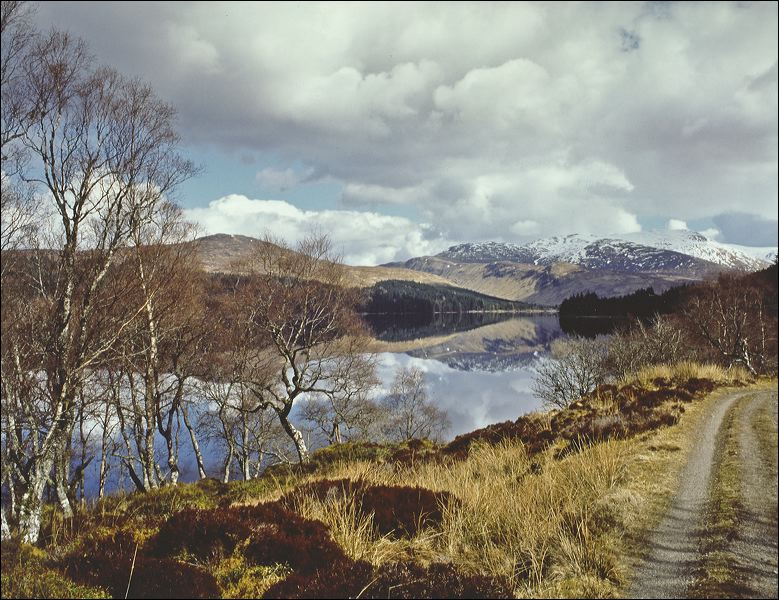
We did no thieving, but of course plenty of tramping! It was about 16km to our camping place, carrying three days’ food and plenty of clothes for the bad weather which never came. The track was easy walking, the first hour or two smooth enough for the luxury cars to the shooting lodge on Loch Ericht. Then we moved away from the loch and up to Culra. The bothy was still there, and no-one knew about its asbestos legacy. We weren’t bothying though, and we took the left bank of the Allt a’Chaoile-reidhe burn for another few km to a dream camping spot. Flat ground, clean water, and Ben Alder towering to the south.
Some of the road we’d followed to Ben Alder was on Roy’s Military Map of about 1750. Move on 200 years, and the area appears in two works by W H Murray. The strange thing to us today is that Murray, a Glasgow man and eminent climber, seemed to be learning about the “Alder Forest” from scratch. He thought it too remote for a weekend trip, too close for an annual holiday. He eventually got there with friends on a mission to find what climbing routes Alder offered.
They found routes; but they discovered much more than that. The sun came out, and in Undiscovered Scotland, 1951, Murray writes movingly about what they saw. “The scale was so much greater than we had appreciated, the land so much more colourful, and by Nature so much better furnished…I should have to come back soon, I decided, and make that walk from Dalwhinnie to Fort William…preferably a week”.
Then in 1962, Murray researched and wrote Highland Landscape for the National Trust for Scotland. The book picks out 21 regions of “supreme landscape value” which include “The range of Ben Alder”, stretching from Kinloch Laggan to Corrour: “the interior is for those who love solitude, and its exploration for the strong walker”.
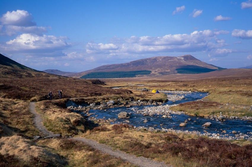
We, strong-ish walkers, bagged our six Munros in two days. The views were superb, and we did an easy 10km of the Thieves’ Road, twice, when returning to the tents from near the 730m Bealach Dubh. The next day, it was tramping back the 16km to Dalwhinnie. Had we been “doing” the Thieves’ Road properly, it would have meant a return to the Bealach Dubh, and then walking on for about another 50 km.
Some of that 50 km I’ve covered on other trips, though sadly all before I had any clue about the road’s history. The track down from the bealach to Loch Ossian, and the Ossian Estate HQ, is less pleasant walking. I wonder now how long it took the thieves with their cattle!
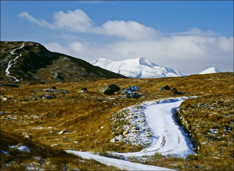
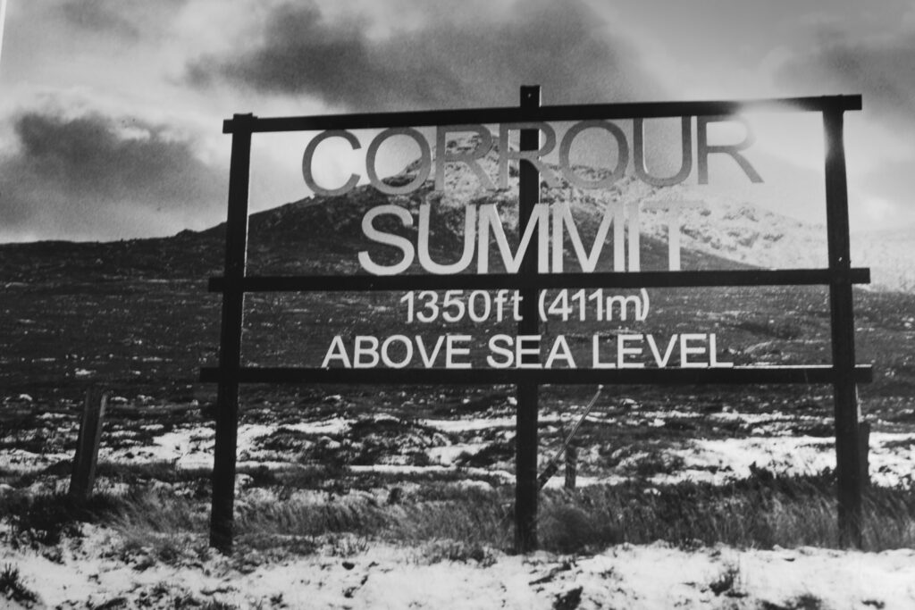
Then the 5km along Loch Ossian is a delight, through the woods planted by Sir John Stirling Maxwell (the owner) between 1890 and 1950. Likewise the youth hostel at the south end of the loch, and the Station House at Corrour rail station, Britain’s highest. There’s an easy walk from there down to Loch Treig, from which we once had a stunning view of the snowy Mamores – in October by the way. Creaguaineach on the loch shore is as far as I’ve gone.
From there to the head of the Water of Nevis there are two bothies, but also dire warnings about river crossings and wet ground. Hard men those thieves must have been.
So, what I’m waiting for is a dry few weeks, a train to Corrour, and a long tramp over to the carpark below the Steall gorge. Never mind the 10km of road from the carpark to the Fort!
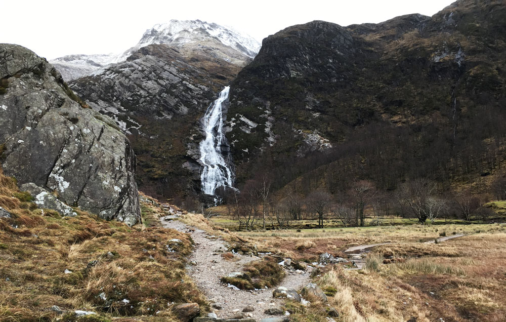
Header image: Steall Falls, above Water of Nevis
* Note from ScotWays: As many readers will be aware, Network Rail unilaterally closed the level crossing along this route at Dalwhinnie in 2021, in spite of ScotWays and others believing the route to be a right of way. ScotWays has been working with The Highland Council, Cairngorms National Park Authority, Dalwhinnie Community Council and other organisations since that time for public access to be restored. For now, a detour south to the underpass at GR NN 63425 84096 is required.