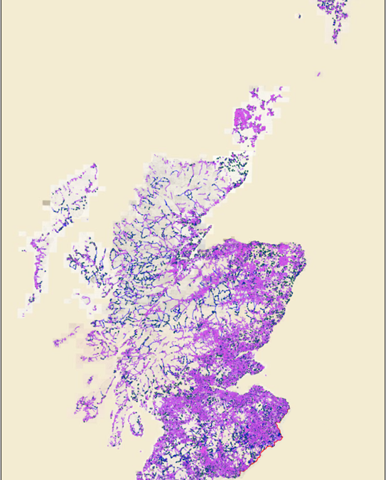
You can now download, explore and view records of over 120,000 footpaths traced from Ordnance Survey Six-Inch to the mile maps of Scotland (1888-1913) thanks to a crowdsourcing map transcription project, a collaborative project between Scotways and the National Library of Scotland.
This dataset contains records for 120,000 footpaths gathered from Ordnance Survey Six-Inch to the mile maps of Scotland (1888-1913). The paths are categorised into those which were labelled Footpath (F.P.) or Bridle Road (B.R.) and those which were not and were traced between April and December 2022.
The Ordnance Survey Six-Inch to the Mile (or 1:10,560) County Series is the most comprehensive, topographic mapping covering all of Scotland from the 1890s to the 1940s. The maps show most man-made and natural features in the landscape and are the most detailed scale at which contours are shown.
The aim of the project was to record paths and tracks shown on Ordnance Survey Six-Inch to the Mile maps of around 1900, to help facilitate Scotways’ work in researching the backgrounds of footpaths today and safeguarding them as rights of way. The initial focus of the project was on recording paths and tracks which were specifically labelled as ‘Footpath’ (F.P.) or ‘Bridle Road’ (B.R.). However, as Ordnance Survey did not assign these abbreviations to many paths and tracks that were clearly footpaths, the scope of the project was widened to include paths or tracks which did not have F.P. or B.R. abbreviations.
You find out more and download the dataset on the National Library of Scotland website or view it on their online maps viewer.