Heritage Path of the Month.
Military Road to Fort William is our Heritage Path of the Month for May 2026. Our historic signpost for this route was recently refurbished by volunteers, click through to the path page to see a picture.
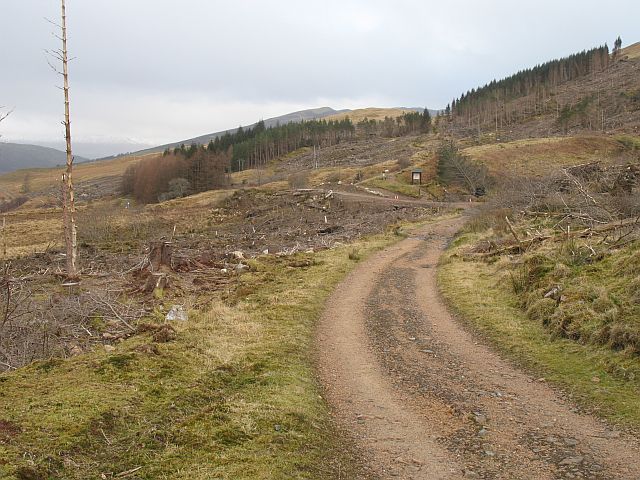
More about the Military Road to Fort William:
The first 11.5km of this old military road is used by the West Highland Way (WHW), so is waymarked accordingly.
Leave Kinlochleven along the B863, until circa 250m west of the bridge (NN183623) over the Allt Coire na Bà. Take the WHW waymarked path to climb northwest up the wooded hillside, and cross the private road to Mamore Lodge. Higher up, it joins the track from the lodge that leads west up the north side of the glen of the Allt Nathrach. The track leads unmistakably over a bealach at about 330m and descends to Lairigmòr. Continue along this track, which swings north to pass the low ruins at Blàr a’ Chaorainn, just before which the WHW has left this old military road. Follow the narrow public road north through Blarmachfoldach and into Fort William.
OS Landranger 41 (Ben Nevis, Fort William & surrounding area)
This Old Military Road was constructed in 1749-50, under the auspices of Major Caulfeild, from Fort William southwards to Kinlochleven. It continues south over the Devil’s Staircase and across the western edge of Rannoch Moor.
Since 1980, much of this route has been followed by the West Highland Way, forming part of the final section for those going from south to north. Other historic routes with links to the WHW include the Bankie Trek, the Crianlarich Military Road, the Old Glencoe Road, the Devil’s Staircase and the Drove Road to Callert Ferry.
More about Heritage Paths
Learn about the history of some of the oldest transport routes in Scotland. Heritage Paths records the history of over 400 routes that criss-cross the Scottish landscape. From Roman Roads to Military Roads, find out how the route you are following came into being.
As well as historical information, you’ll find a modern-day route description along with start and finish details. Change the background mapping in our interactive viewer and time travel along your favourite Heritage Path from 1843 to today.
Photo © Richard Webb, Geograph