by David Oxley | 11 September 2025
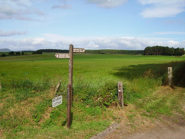
The line of what appears to be an old road can be traced for most of its route from Blairdhu NH 577502 near Kilearnan/Redcastle for 6.5 kms in a NW direction to Davids Fort NH 539540 near Conan House. It exists on the ground as a modern minor road, as a farm track, as...
by David Oxley | 11 September 2025
We don't yet have a full survey of this route, but in 2006 it was upgraded to be a safe route to Kilmartin Primary School, so should be very accessible. OS Landranger 55 (Lochgilphead and surrounding area)

by David Oxley | 11 September 2025
If the route is done south to north there are no real route finding issues* beyond crossing the boggy section and heading into the trees from the south side of Mannoch Hill. If the route is done north to south then there is an unclear cutoff of the track on Mannoch...

by David Oxley | 11 September 2025
We have no survey of this route yet and would be very grateful to receive one. OS Landranger sheet 55 (Lochgilphead and surrounding area)

by Eleisha Fahy | 11 September 2025
From the edge of the woods northeast of White Rig, head southeast along the minor road to the crossroads west of Shiplaw. Follow the track which forms the crossroad’s southward arm for 4km by Stewarton, and onwards for 3km to pass between Black Meldon and White...