As we’re now well into autumn, we’ve compiled some great routes from our staff and directors to experience the changing colours across Scotland.
Route 1: Crook of Devon to Dollar
Route description:
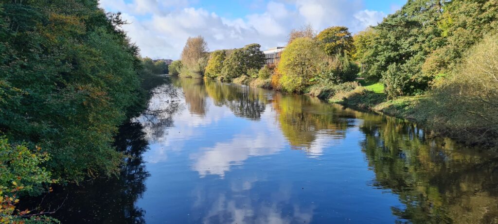
“The perfect autumn walk, even when the sun isn’t shining. Take in the breathtaking autumn colours and dripping mosses at the spectacular gorge at Rumbling Bridge and gaze up at stunning views of the Ochils blanketed in golden-russet bracken. Following this, finish at one of the many cafés in Dollar for refilling on coffee and delicious home baking. The return to Crook of Devon is available on the No. 23 community bus, which runs hourly. The route leaves Crook of Devon on a path heading south before turning west along Church Road and returning to cross the A977 and head along the babbling River Devon to Rumbling Gorge. From there, the path leaves the river and heads down to the old Muckhart Mill and Limekiln. It then joins the Old Cart Track to Muckhart before heading up into Dollar along a quiet road.”
– Johanna Babbs (Access Officer)
Start point: NO 032 001
End point: NS 962 979
Distance: 9km
Route 2: River Ayr Way to the Auchincruive Estate
Route Description
“It is a fine riparian walk following the River Ayr through the centre of Ayr, past a number of smallholdings on the urban periphery, many used for equestrian purposes, to the former estate of the merchant and MP for Glasgow, James Oswald (whose predecessors had associations with the slave trade), last used as the west campus of the Scottish Agricultural College, then through mixed deciduous woodland, past ‘Wallace’s Seat’ and along fishermen’s paths to the former mining village of Annbank”.
-Neil Feggans (Access Officer)
Start point: NS 344 213
End point: NS 382 232 and thereafter NS 405 228
This route is, in part, a section of the third stage of the River Ayr Way.
Distance: approx 9km
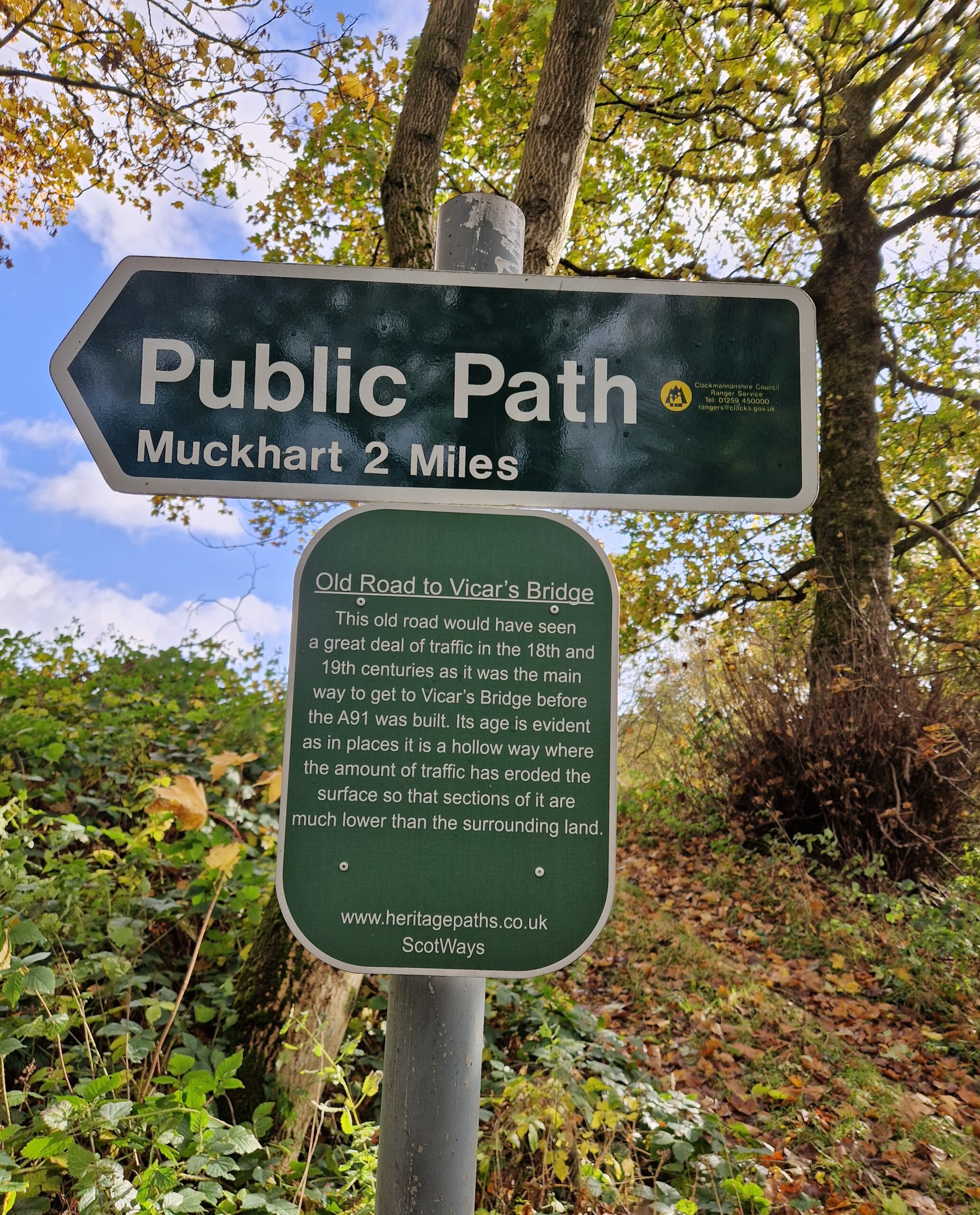
Route 3: Old Luss Road
Starting from the Old Luss Road route from Craigendoran (Helensburgh).
Route description:
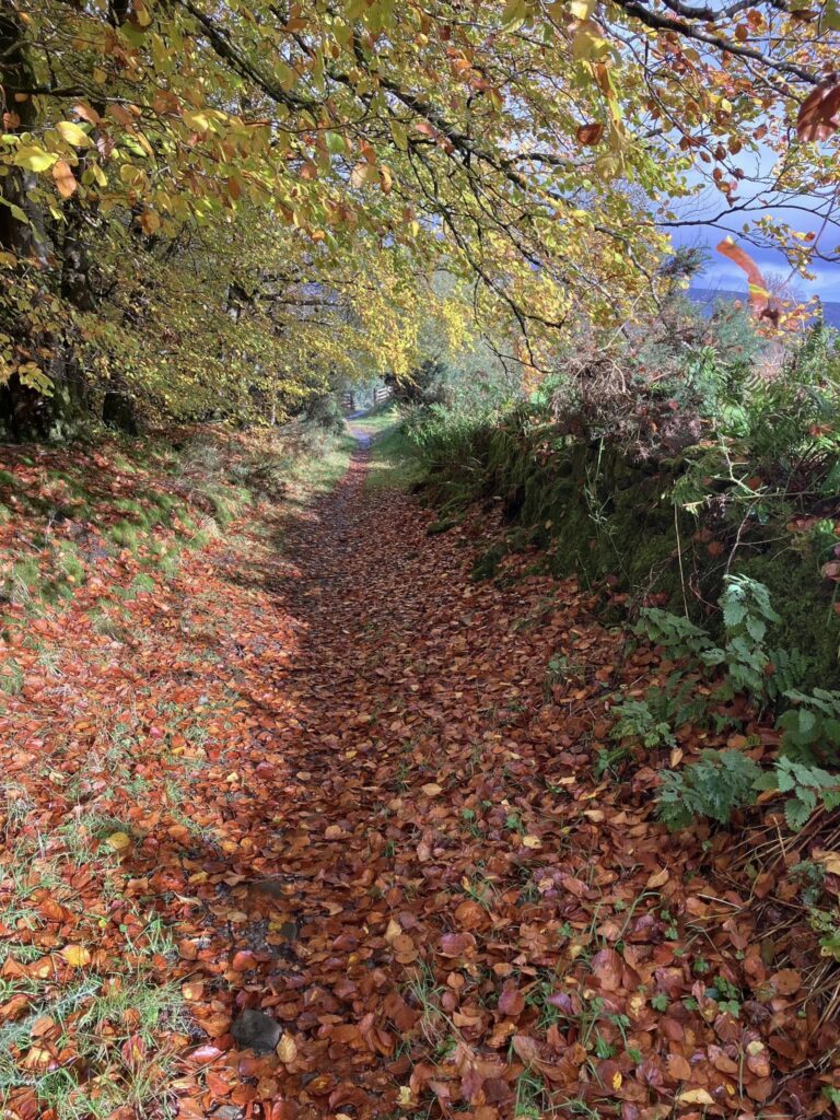
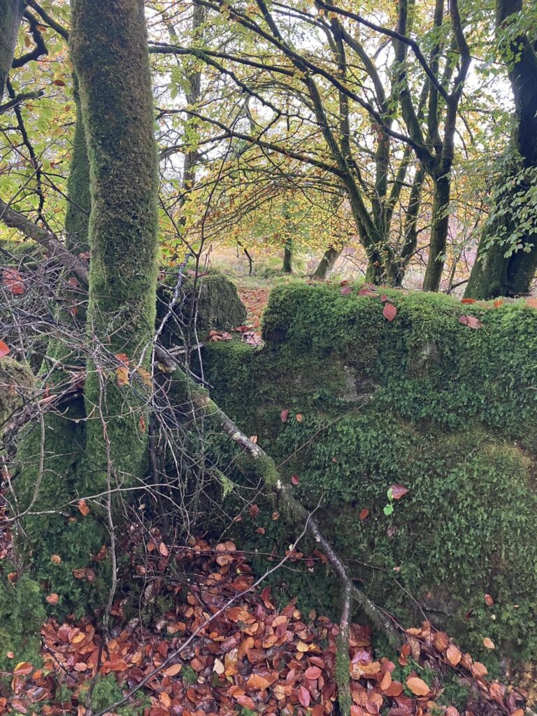
“This very short walk is local to me and is full of gorgeous colour in the autumn. This section of the old road to Luss starts in the northern part of Craigendoran and goes through to the A818. It’s only about a mile long, but there are many options for turning it into a longer circular walk. This old section of road is clear on the ground and goes through lovely woodland, but there’s a place where the route splits, and an old, forgotten, and mostly disappeared old path branches off to the northeast along a bit of a causeway through the bog. If you look carefully, you can spot a gap at the top of the stone wall where the routes split, where walkers used to cross over to the now-forgotten road (see image below). The steps of a stone stile can still be seen on the other side of the wall.”
– Rachel Taylor (Director)
Start location: NS 309 829
End location: NS 312 810
Distance: approx 1.6km
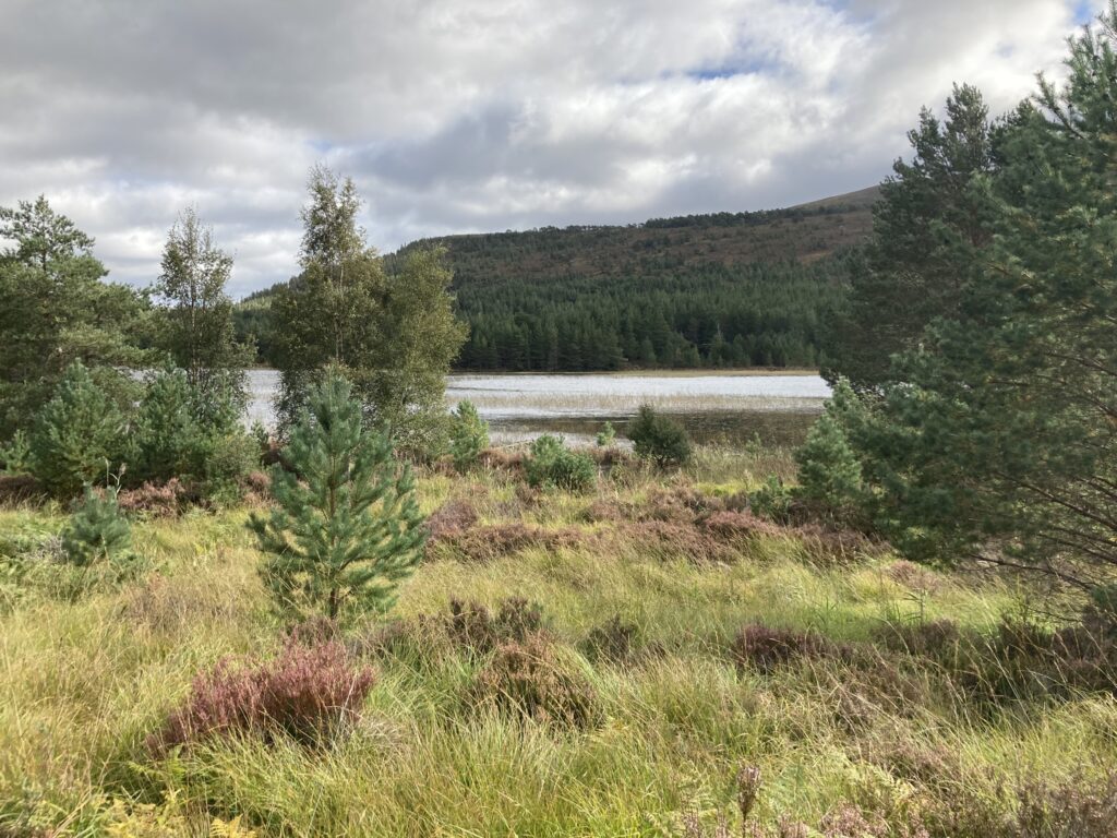
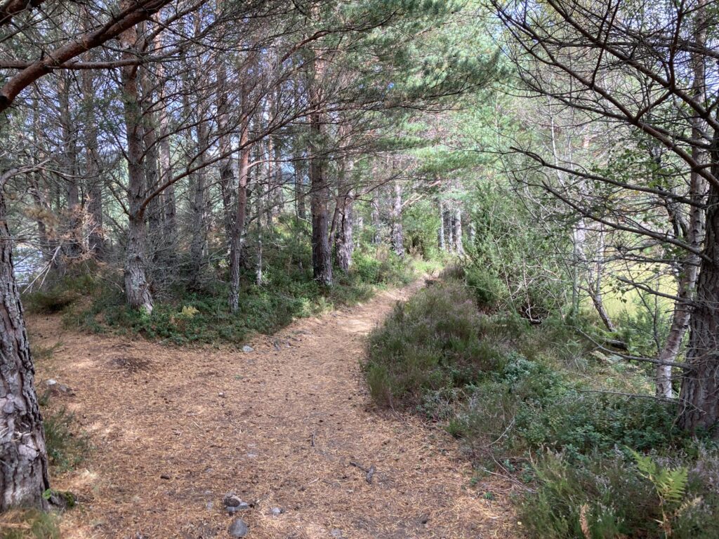
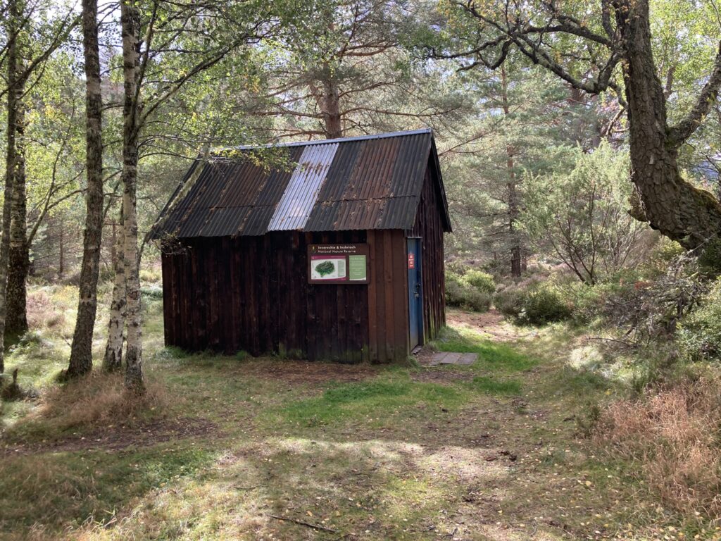
Route 4: Feshiebridge to Nethy Bridge
Route description
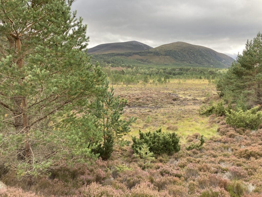
“The colours were starting to change, and it was a great walk for a windy day (the MWIS forecast was for 70mph winds on the tops!). These photos are of Inshraich Bothy and the section between Feshiebridge and Loch an Eilean.”
-Tim Simons (Director)
Start point: NH 851 043
End point: NH 890 077
Distance: 7km
This is a part of the Scottish Hill Track route 208. A description of the full route can be found in Scottish Hill Tracks.