
by Eleisha Fahy | 11 September 2025
Newsflash! The Heritage Paths (Campsie Fells) Project is very pleased to announce that we have a lovely Campsies map leaflet showing this old path and other routes in the area. To get your hands on one, simply send head over to our shop. This route starts along a...
by David Oxley | 11 September 2025
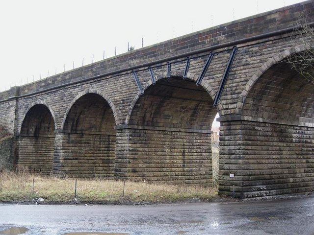
This route runs along the south side of the railway from Croy Station to the next public road to the west a kilometre away at the railway viaduct south of Drumglass. A sign-posted tarred path leads away from the B802 between the upper and lower station car...
by David Oxley | 11 September 2025
The Bogie Line path starts at Croy Station and follows the south side of the railway line in an easterly direction. After about 1.5km, either continue straight ahead to reach the Wester Dullatur railway bridge which enables access to Croy Hill or...

by David Oxley | 11 September 2025
These are two separate access routes used during construction of the Blackwater dam, one from Kinlochleven in the east and the other from Altnafeadh in the south. They meet at the dam (NN246599). That from Kinlochleven is the more straightforward as it initially...