Monks’ Road Show path on map
Start location: Marchbank Works, south of Balerno ( NT 167 643 )
End location: A702, Nine Mile Burn ( NT 179 577 )
Geographical area: Lothian and Borders
Path type: Rural Path
Path distance: 8km
Accessibility info: Suitable for pedestrians
Route Description
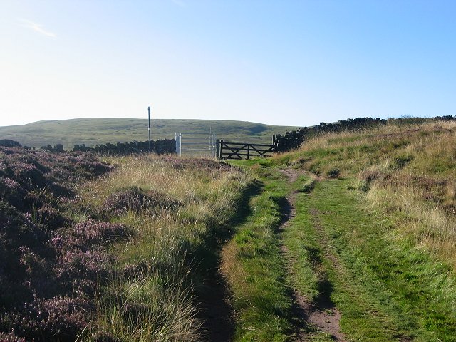
From Balerno, head past Marchbank and take the left fork just past Redmoss House. Go straight on to cross Threipmuir Reservoir by a bridge and go up the steep avenue. At the top, turn right then left to go south over the west shoulder of Hare Hill, then downhill slightly to cross the source of the Logan Burn in the Kitchen Moss. From there climb east to the col on the south-west side of West Kip, then uphill to the right over Cap Law and the Monks Rig and past the Font Stone to Nine Mile Burn.
Part of the Monks Road has been incorporated into the waymarked Pentland Way from Dunsyre to Swanston.
OS Landranger 65 (Falkirk & West Lothian)
Heritage Information
We can not be sure of the origin of the description of this route as the "Monks Road", or the burn in the adjoining valley as "Monks Burn". With the existence of the font stone, with the hill to the West being named "Spittal Hill" and with "Spittal Farm" at the foot of Spittal Hill, there might seem to be some connection with some sort of mediaeval refuge, although we do not have hard evidence of this. According to D.G. Moir the font stone was probably a socket for an ancient cross, which may have marked the pilgrimage way between the theoretical monastery at Newhall and Queensferry. (In 1835 several old copper coins were found beneath the cross). On the other side of Monks Burn is the farm of Spittal, which was possibly the hospice, an outpost of the monastery.
It has also been suggested that the word "Monk" is associated with the activities of General Monk in the mid-17th century.