Old Coal Road Show path on map
Start location: B6357, Dinlabyre ( NY 529 921 )
End location: Lewis Burn, road by Kielder Water ( NY 644 902 )
Geographical area: Lothian and Borders
Path type: Industrial Path
Path distance: 15km
Accessibility info: Suitable for bikes, Suitable for horses, Suitable for pedestrians
Route Description
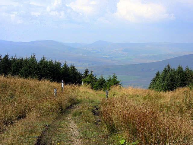
From Dinlabyre, go east uphill by a forestry road past Mountain View. Continue southeast to NY548907 where the track turns northeast towards Larriston Fells. It then crosses open ground at about 500m, diverging from a radio mast’s track at NY560913, to head east-southeast towards Bloody Bush on the Scottish/English border which is marked by an ashlar masonry toll pillar.
Beyond the border, the old coal road is now within the Kielder Water and Forest Park and is joined by its Bloody Bush MTB trail. Follow this down by Grains Burn and Akenshawburn to The Forks. From there head down beside the Lewis Burn to reach the minor road along Kielder Water.
As well as being a popular mountainbiking route, the old coal road is also promoted for equestrian use as part of the South of Scotland Countryside Trails network.
OS Landranger 79 (Hawick & Eskdale) and 80 (Cheviot Hills and Kielder Water)
Heritage Information
In the nineteenth century, this road was used to transport coal from Northumberland's Lewisburn Colliery over the border into Roxburghshire. At least two bridges on the route are dated 1828; the toll pillar at the border was set up in the 1830s.
The inscription on the toll pillar is interesting for what it tells us about likely users of the road at the time the toll was established. The writing is hard to read in places, but says something like:
The MARCH between NORTHUMBERLAND & ROXBURGHSHIRE
Willowbog the Property of Sir J.E. Swinburn Bar. Capheaton
Dinlabyre the Property of William Oliver Rutherfurd Esqr.
PRIVATE ROAD upon which a Toll Gate is erected near Oakenshaw Bridge at which the following Toll rates are exacted viz 1st For horses employed in leading coals - 2d. each 2nd all other horses - 3d. do. 3rd Cattle - 1d. do. 4th Sheep, Calves, Swine - 1/2d. do.
The above tolls exacted once a day.
N.B. Persons evading or refuseing to pay at the above mentioned toll gate will be prosecuted for trespafs.
DISTANCE from this place BLOODYBUSH
To Lewisburn Colliery 5 miles
Maunces 8 do.
Bellingham 23 -
Hexham 37 -.
Dinlabyre 3 1/2 -
Castleton 7 1/2 -
Hawick 21 -
Jedburgh 25 -
The coal road is thought to have fallen into decline with the opening of the Border Counties railway in the 1860s.
As for Bloody Bush, the pillar's named location on the border, this has an older provenance than the transportation of coal. Unsurprisingly it relates to a Border skirmish - this is said to be the site where a a party of Northumbrians met their death whilst returning from a raid into Liddesdale.