Kenmore to Amulree track Show path on map
Start location: north side of Wade bridge, Amulree ( NN 900 368 )
End location: Kenmore ( NN 775 452 )
Geographical area: Perth, Kinross and Stirling (part)
Path type: Drove Road, Rural Path
Path distance: 17km
Accessibility info: Suitable for bikes, Suitable for pedestrians
Route Description
Most of this old route is now used by the Glen Quaich alternative section of the Rob Roy Way (RRW), a long distance route from Drymen to Pitlochry.
On the north side of Amulree’s military bridge, a right of way signpost ‘Footpath to Kenmore’ points along a rough road which heads west up Glen Quaich to the north of the River Braan and Loch Freuchie. At Turrerich (NN856390), the onward line of this old route is reportedly very boggy, which may be why the RRW diverts off it, rejoining at Shian (NN844397) – the Heritage Paths project would welcome an update on this, but at least the RRW provides a ready alternative. Either way, continue west past Tirchardie to join the single-track road over the Lairig Mile Marcachd (RRW leaves it at NN800431) to reach Kenmore. Lairig Mile Marcachd – the pass of the mile of riding – is so named because of the level part on the summit.
OS Landranger 52 (Pitlochry and Aberfeldy)
Heritage Information
A road has linked Amulree and Kenmore for a very long time and a route is shown in Roy's Military Survey of 1747-55. The route shown in Roy is the road that runs to the south of Loch Freuchie although both roads are later shown in early OS maps. It looks like the road shown in Roy was the more important of the two, but the track to the north will see far less vehicular traffic and so is likely the more pleasant to walk.
Interestingly the route shown in Roy goes completely off the track that we currently use at NN804421 to the west and crosses the current road at the car park before entering Kenmore from the east. None of this old section of the road is shown on current maps and so is likely to be completely gone.
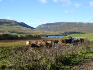
Haldane's book The Drove Roads Of Scotland (1952) suggests that the drove road between Kenmore and Amulree continued in use until the early nineteenth century. Haldane also refers to an earlier more nefarious use of the route in quoting Mackintosh of Borlum - in 1742, the latter wrote of Kenmore, "a very frequent and beaten Pass for driving stolen cattle from Perthshire, Stirlingshire, Kinross and Clackmannan into Glenlyon, Rannoch, Breadalbane, Glencoe, Appin and Lorn".
The droving history can be taken further back than that though as the Amulree Hotel (now sadly closed) was founded as a drovers' inn in 1714. Sitting as Amulree does at a crossroads of old routes, it is perhaps no surprise that it had a Tryst in May, which existed even before the more famous Tryst was established at Crieff.
