Inverie to Glen Dessarry Path Show path on map
Start location: Strathan (Loch Arkaig) ( NM 987 916 )
End location: Inverie River ( NM 797 991 )
Geographical area: Lochaber
Path type: Rural Path
Path distance: 27km
Accessibility info: Suitable for pedestrians
Route Description
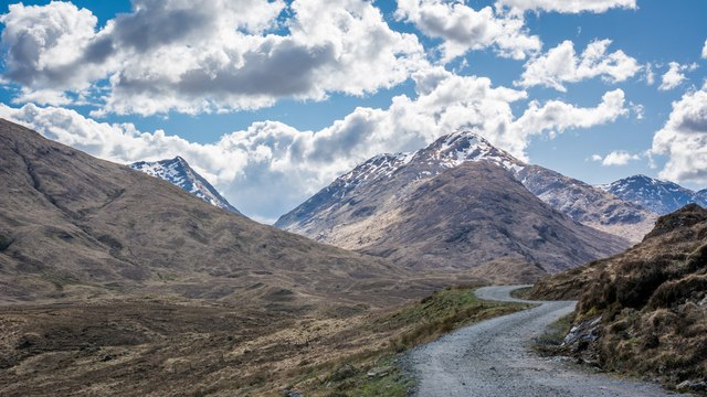
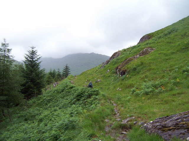
Start from the end of the public road near Strathan. Go up the private road on the north side of Glen Dessarry past Glendessarry Lodge and Upper Glendessarry. About 2km west of Upper Glendessarry, take the path above the forest to cross the Allt Coire nan Uth (if in spate, use the bridge downstream, which is out of the sight of the path) and continue to the top of the pass, the Bealach an Lagain Duibh (310m), about 8km from Strathan. Continue west along a very rough path through the narrow defile of the Mam na Cloich Airde, then by a better path down to Sourlies bothy (MBA) at the head of Loch Nevis. Then go along the flat sandy shore at low tide, or over the headland at high tide, to reach the grassy flats at the outflow of the River Carnach, and cross the river by a bridge* near the ruins of Carnoch village. From Carnoch, climb steeply northwest on a good path to a high pass, the Mam Meadail (550m), then down Gleann Meadail to cross the Inverie River and join the Old Road to Kinloch Hourn, turning west along which leads down to Inverie.
OS Landranger 33 (Loch Alsh, Glen Shiel & Loch Hourn)
Heritage Information
This old track appears in a number of old maps such as the 1st edition of OS 6 inch to the mile maps of the mid 19th century and the section from Loch Nevis to Loch Arkaig is depicted as a double lined road in John Thomson's Atlas of Scotland (1832). The path descending to the head of Loch Nevis was well constructed and at one place was even paved. It is probable that it was built at the time of the herring boom on the north-west coast when Loch Nevis was an important fishing ground, and the path was used by ponies carrying barrels of herring to the markets further south. The northern section of this route may have been used less and so may have not been in a good enough condition for Thomson to have included in his atlas.
*In 2019, a new bridge replaced the suspension footbridge (NM865964) over the River Carnach which following deterioration and damage had been closed and removed the previous year. The bridge was rebuilt by the Camusrory Estate with contributions from ScotWays, the Scottish Mountaineering Trust, Mountaineering Scotland, the Mountain Bothies Association, the Donald Bennet Memorial Fund and others.