Hexpethgate (Clennell Street) Show path on map
Start location: Primsidemill ( NT 813 265 )
End location: Scottish/English Border ( NT 871 161 )
Geographical area: Lothian and Borders
Path type: Drove Road, Medieval Road
Path distance: 14.5km
Accessibility info: Suitable for pedestrians
Route Description
From Primsidemill, go southeast by Clifton, up Kaim Rig and over the east shoulder of Black Hill. Head through forest to the col between the Curr and Blackdean Curr, then down to Auchope in the Sourhope valley. From there, head upstream past Schilgreen (NT857215), then south over the hill to the Dod Burn and ultimately further south to Cocklawfoot.
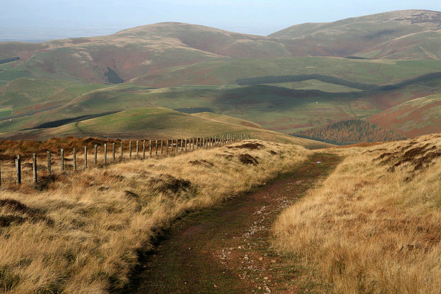
From Cocklawfoot, pass through a gate and follow a clear grassy track uphill through a conifer plantation and ever upwards, passing through a single gate before arriving at the border fence gate, where a signpost reads “Clennell Street, Pennine Way”.
OS Landranger 80 (Cheviot Hills & Kielder Water)
Heritage Information
This old crossing of the Border was known as Hexpethgate; it is mentioned in a state paper of 1543 (Henry VIII Domestic Series XVIII) as one of seventeen crossings of the Cheviots. The Cocklaw was a regular meeting place for the Wardens of the Marches. The route is marked on a lot of old maps and there is thought to have been a cross placed at the point where the road crosses into England to commemorate the killing of Lord Russell on 27th July 1585. On Roy's military mapping (1752-55), this route is marked "Road from Morpeth to Kelso". The section north of Auchope is labelled "Windy Path" on the OS 6" (1892-1905) and 1:25,000 (1937-1961) mapping. South of the Border, the track is known as Clennell Street.
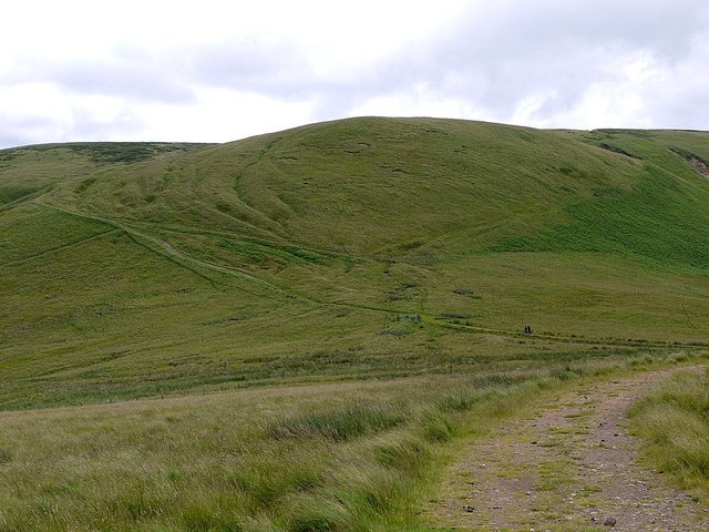
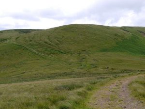
At Outer Cock Law, the amount of traffic and the topography have combined to force people using the road to take diversions and create new roads. This has resulted in around nine roads being created in a very short space; these are visible in the landscape as holloways where the traffic has eroded the land so that it is much lower than the surrounding land. Holloways tend to be found in medieval roads that received a huge amount of traffic as they wouldn't have been surfaced with anything substantial enough to stop the road surface from eroding. The presence of a number of holloways on this road and the possible cross at the Border suggest that it is medieval in date. It also links with a medieval Salters' Road in England.