Old Road through Straiton Show path on map
Start location: Dalquhairn Bridge ( NX 329 969 )
End location: Whitehill, west of Patna ( NS 407 106 )
Geographical area: Arran and Ayrshire
Path type: Civil Road, Drove Road
Path distance: 18.8km
Accessibility info: Suitable for pedestrians
Route Description
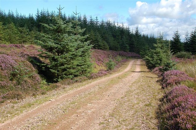
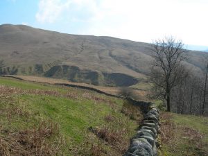
Today much of this route goes through developed forests, which causes difficulty with following the original route, so diversions are required to approximately follow it.
North and South Balloch sit either side of a bridge (NX329956) over the River Stinchar. From here, the start of this old route can be reached by heading north by road for 1km to Sally Pollock’s Bridge over the Dalquhairn Burn. To avoid an un-necessary off-road water crossing, continue along the road to Dalquhairn Bridge (NX329969).
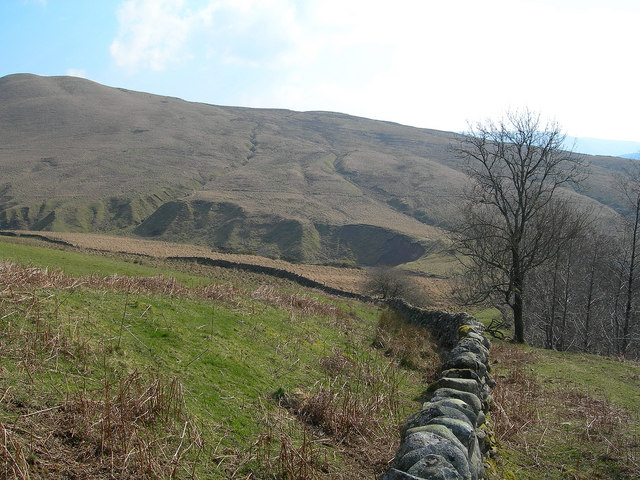
Having crossed this bridge, turn right steeply uphill, then head initially southeast then south to contour around the lower slopes of Auchengairn. Strike northeast on the north side of the Dalquhairn Burn for 1.5km to enter the forest. Some 500m further on, enter a marshy clearing, keeping the burn on the right. Turn left into a ride at NX349977. Proceed north-northeast steeply uphill, following a small burn, to reach a forest road (NX350982) to the south of Glester Cairn. Turn right, and continue east and north for 1km to a junction at NX359987.
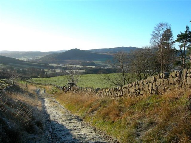
Here the old route continued northeast, leaving the forest at NX366999 to cross the Palmullan Burn at NS372008, and follow the burn downstream past Knockskae. In light of the forestry difficulties, the following is suggested as a diversion – at NX359987, instead turn left and follow the road northwest until reaching a burn crossing at NX344994). Follow this burn north steeply downhill towards Glenalla, arriving at a crossing of the Palmullan Burn (NS345001), with Glenalla on your right/east. Follow a track uphill to a junction with a forest road at NS347005. Turn right/east and follow the road which becomes a forest track skirting the lower slopes of Knockcronal. Go past Knockskae (on your right) and continue north downhill to reach a junction at NS370016. Bear right/east downhill, past sheep pens on the right and through a gate to re-join the old route. Turn left to follow the road past Dalmorton and Balbeg to Craigfad. Here, join the waymarked path following the west side of the Water of Girvan to reach Straiton.
To continue to Patna, leave Straiton northwards then east for 500m following the B741 to NS384051. Here a minor road leads northeast uphill past Glenhead for 1km to a plantation. Enter this by a forest ride and proceed uphill through the forest to join a track. Continue straight on northeast until the track bends sharply left at NS391066, and here, leave the track to follow a ride northeast, past the ruins of Dhu Loch Cottage (NS394072) on your left. Continue past the cottage for 200m, crossing a fence and a small burn (NS395073). From here, again the old road is affected by forestry. We suggest heading east upstream for 150m through a clearing, before bearing left to follow a forest ride northeast. There has been considerable deforestation in this area, but from the forest edge at the end of the ride (NS399075), bear north across open marshy ground with broken trees, brash and mossy tussocks. Passing the end of a forest road on the right (NS398078), continue north downhill to a bridge (NS398080) over a burn at a point 200m east of Loch Spallander Reservoir. Bear uphill, and go through a gap in a drystane dyke to head east and then north, regaining the old road’s alignment by following a forest ride (keeping another drystane dyke on the right) to reach a forest road (NS399087). Here it again becomes necessary to divert from the old line – turn right and keep on this forest road striking northwest at NS406088, then turn northeast just beyond a disused pit at Kirklafinn to ultimately join a minor road at Whitehill, just west of Patna.
OS Landranger 76 (Girvan & surrounding area) and 77 (Dalmellington to New Galloway) – also 70 (Ayr, Kilmarnock & Troon)
Heritage Information
This path was mapped by General Roy in his Military Survey (1747-1755). Roy didn't tend to map out footpaths or minor roads and so it must have been a very important route. It was noted down as the road from Dalmellington to Wigtown and so would have seen a huge amount of traffic between the two. The route is also said to be shown on Armstrong's 1773 map of Ayrshire.