Muchty Road Show path on map
Start location: Glen Road, Abernethy ( NO 188 139 )
End location: Mournipea, Auchtermuchty ( NO 235 121 )
Geographical area: Fife, Perth, Kinross and Stirling (part)
Path type: Drove Road
Path distance: 5.5km
Accessibility info: Suitable for bikes, Suitable for horses, Suitable for Motorised wheelchairs, Suitable for pedestrians
Route Description
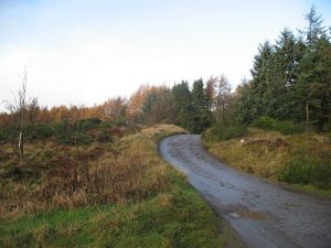
This old route leaves the B936 (Newburgh Road) in Auchtermuchty at NO235121, following a minor road Mourniepea northwest. Pass turnings for Newton and Reediehill, and soon after Newhill, the route becomes a forestry road with a gravel surface. Circa NO193136, the older route and the forestry track diverge – the latter is more accessible, but both lead to the minor road through Abernethy Glen between Glenfoot and Strathmiglo. There are also other more modern tracks through the forest to Abernethy itself.
OS Landranger 58 (Perth & Alloa, Auchterarder)
Heritage Information
The Muchty Road is an old drove road that would have been used by people taking cattle and sheep to market. Auchtermuchty's entry in the Old Statistical Account (1793) states it had at that time four fairs a year - the one on 13th July being the most considerable in Fife for the sale of black cattle, horses, sheep, wool etc. The Muchty Road was possibly also used to reach market in Cupar or, in the other direction, to the big Trysts at Crieff. One of the few drove roads so far identified in Fife, it must have seen a great deal of traffic. That said, the parish of Abernethy's OSA entry (1794) reports that the road which strikes off Abernethy Glen to Auchtermuchty is in winter almost impassable - statute labour and associated compensation being totally inadequate to keep it in repair.
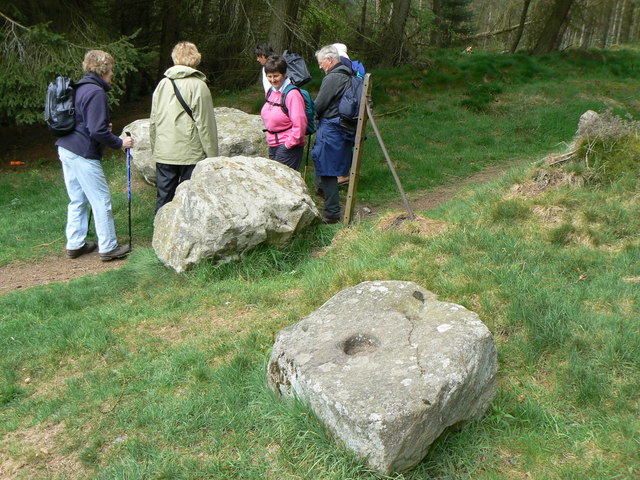
The route crosses the current local authority boundary at NO203137, but this is an older district and parish border also. Here there is the remains of a "howf" or Thirl Stone, a large boulder with a hollow in the centre of its top surface. This is said to be where there would have been a pole and weighing device, presumably for wool sacks or produce for the markets.