Tayport Coffin Road Show path on map
Start location: B945 near the former Burnbank Nursery ( NO 455 278 )
End location: Junction of Pond Lane & Elizabeth Street, Tayport ( NO 458 283 )
Geographical area: Fife
Path type: Coffin Road
Path distance: 0.6km
Accessibility info: Suitable for pedestrians
Route Description
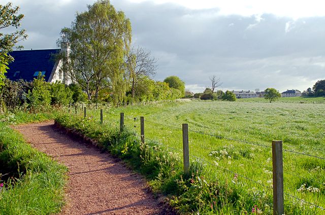
At Arnoldsland on the B945, a gravel path leads N.E. along a burn/drain at the back of the now apparently disused nursery. Another path leaves it at approx. 457282 leading to the tennis courts. The main path continues in N.E. direction to pass the end of New St. and into Elizabeth St. opposite the end of Pond Lane.
OS Landranger 59 (St Andrews, Kirkcaldy & Glenrothes) or 54 (Dundee & Montrose)
Heritage Information
This is a path well known locally as a coffin walk and as such it would have seen a lot of use as people carried their dead to the church that would have been located quite far away.
The path probably joined the B945, as it does today, and then conitnued south taking the south west turn off at Lawhouses to be buried at Forgan Church or the cemetary about a kilometre west of that. Therefore this path is a very small part of what would have been a considerable journey carrying what would potentially have been quite a heavy weight. The path would probably also have been used by churchgoers every Sunday as well and so must have been extremely well used.
Gallery