Bunavullin Coffin Roads Show path on map
Start location: Laudale, Loch Sunart ( NM 756 598 )
End location: Shore at Doirlinn, Loch Sunart ( NM 607 585 )
Geographical area: Lochaber
Path type: Coffin Road
Path distance: 47km
Accessibility info: Suitable for pedestrians, Survey required
Route Description
These two routes through Morvern pass deserted settlements. Our route descriptions both start at Bunavullin.
Bunavullin to Doirlinn (11km): From Bunavullin, head north at first on the B849, but at NM559538 where it bends left, instead take the track on the right which passes Achnacriche. Ignore a right turn for Achleanan farm, but fork right at the next junction signposted for Doirlin and Nc’nean Distillery. The track climbs past distillery buildings and onwards above the abandoned settlement of Auliston (see detour below). Ignore a left turn entering the forest over a cattle grid but take the next left, skirting the forest and leading eastwards towards Portabhata. The track eventually drops down wooded slopes down to Doirlinn.
In order to visit Auliston, turn left off the track at NM553566, about 3km north of Drimnin House, immediately north of a small burn (before the series of bends on the main track). Head northwest for about 700m, following the southwest fence of the forestry plantation.
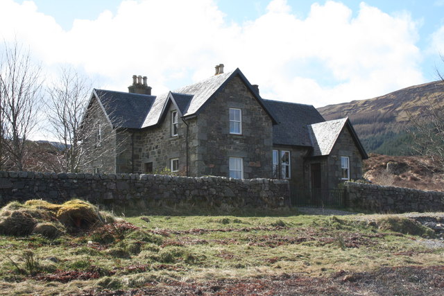
Bunavullin to Laudale (36km): From Bunavullin take the track northeast then south uphill to Mungosdail farm, passing very close to the house and continue through the forest for 1.5km. Just after crossing a burn, take a small path northeast from NM583533 to the edge of the forest at a gate (NM593542). In 1794, there were corn mills and a kiln at Mungosdail.
Continue northeast over the hill (no path) keeping to the east of Lochan Chrois Bheinn as far as NM601550, then over a stile into Barr Forest. Follow a path then a track to Ardantiobairt at the head of Loch Teacuis, where the school (no longer used) can be seen just short of the public road at Kinlochteacuis. From the Kinloch/Rahoy road junction (NM658547), take the track to the northwest around Loch Teacuis as far as NM646557 near Carnliath. Go east-northeast up the north side of the Allt an Inbhire by a waymarked route to the Bealach Sloc an Eich (pass of the hollow of the horses), to the west of Beinn Ghormaig (452m). Descend steeply through the forest to Glen Cripesdale, crossing a bridge over the Glencripesdale Burn at NM661592. Then follow the track east along the north side of the burn for 2km, leaving the burn to follow a path uphill through clear-felled forest, assisted by waymarkers, then along its northern edge to reach Lochan Dhonnachaidh (Duncan’s Loch) at a height of 300m. On the path, there are stone seats every 800m or so, possibly to allow the ladies of the house to rest while on their way to watch the men fishing. There are first class views to the west and north from the track near the lochan. The track then drops down through the forest to join the shore track at NM734603. Laudale House is passed to reach car parking at NM756598.
The route from Drimnin to Doirlinn and that from Drimnin to the Barr River are both reportedly accessible by mountain bike.
OS Landranger 47 (Tobermory & North Mull) and 49 (Oban & East Mull)
Heritage Information
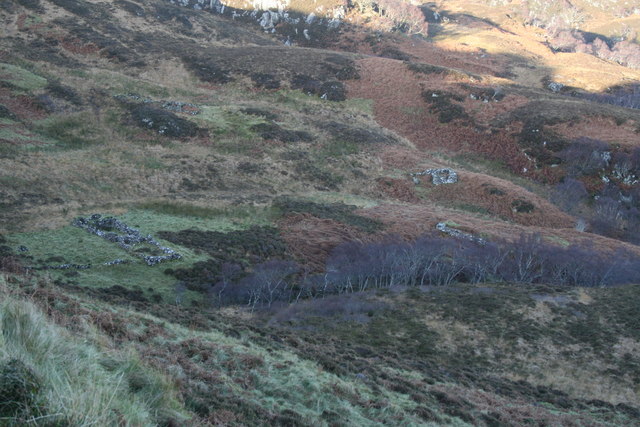
The route round the western tip of Morvern from Drimnin to Doirlinn passes along a former public highway built in 1880 as a poor relief project. It passes old settlements some of which were inhabited at that time, but are now long-since deserted. In 1836 most of the 341 inhabitants of the estate subsisted on some sheep and cattle rearing, a limited amount of arable farming (corn and potatoes) and fishing. However by 1861 clearance of the townships had started in order to make way for sheep farming and the population fell from 118 in 1861 to 58 in 1891. Auliston township itself had a population of 115 in 1851. The remains of this settlement can still be seen with individual houses being found right down to the shore. Portabhata means boat haven. The wall which you see here was built by men on poor relief in 1847. Most of the people in the west of Scotland at this time were destitute due to the failure of the potatoes crop from blight in 1845 and 1846. Potatoes were, as in Ireland, the staple crop.
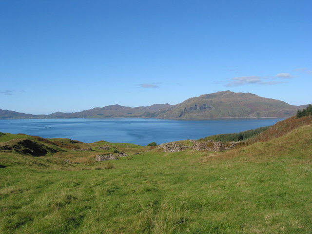
Doirlinn is the Gaelic word for an isthmus, where one can reach an island (in this case, Oronsay) by wading at low water. Six families who had been evicted from Auliston came to settle here and carried out many improvements to the land. However, this was to no avail as they were in turn evicted from Oronsay in 1868 to permit large-scale sheep farming.
The total sheep population of Drimnin Estate in 1794 was about 750 but by 1850 this had increased to 2500. These farms themselves suffered very quickly from competition with cheap wool imported from Australia; between 1864 and 1870 the price of wool dropped by 50%.
In 1824, Inniemore, Mungosdail, Barr and Ardantiobairt were purchased by Miss Christina Stewart of Edinburgh. She hardly ever visited the property and commenced the first large-scale evictions in Morvern, there being some 135 people living in these townships at that time. The following is the story of Mary Cameron of Aoineadh Mor (Inniemore):
"The day of flitting came... it was necessary to depart. The hissing of the fire on the flag of the hearth as they were drowning it reached my heart. We could not get even a bothy in the country, therefore we had nothing for it but the face the land of strangers (Lowlands). My mother-in-law was then alive, weak and lame, and was carried by my husband on his back. I followed with an infant at my breast and the other children. Our neighbours carried the little furniture that remained to us. We sat for a time on Knock nan Carn to take a last look at the place where we had been brought up: the houses were already stripped and the bleat of the ‘big sheep’ (Cheviots) was on the mountain".
In the 1990s, Inniemore came back to light as tree felling took place. Beside the public road to Kinlochteacuis (Kinloch on 1:50k map) from the A884 is a car park (NM668517) with signposts and information boards; paths provide access to the remains of the township at NM656519.
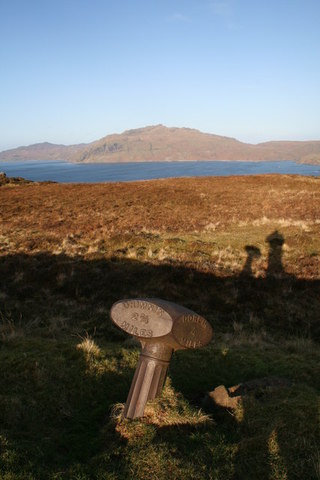
Although the road to Doirlinn is said to have been built as a poor relief project in 1880, the OS 6" map surveyed in 1872 clearly shows the route on its present line, so the work is likely to have been the improvement of the existing road. It is not clear whether the series of cast-iron mileposts along the road date to when the road was improved, when it was upgraded as a public road in the early twentieth century, or to when it returned to the estate in the 1950s. The mileposts were made by Smith, Patterson and Co of Pioneer Foundry, Blaydon-on-Tyne; the firm being in existence between 1870 and 1954. We are not sure how many remain, at least one of the seven originally installed is known to have disappeared.
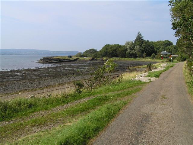
There was an Inn in existence at Doirlinn between 1841 and 1872, and there was also formerly a ferry between Doirlinn and Glenborrodale across Loch Sunart. This Inn is said to have served as a drovers' change-house until about 1880, for cattle crossing from Glenborrodale. If this is the case the droves may well have followed this road to Morvern's cattle sales, or to the Bunavullin ferry and thence onwards to the cattle markets on Mull. Achnacriche, by Bunavullin, is also said to have been a drovers inn. Doirlinn's inn later became a local school, and when that in turn closed, the children of Doirlinn walked this track to Drimnin each week for their education.
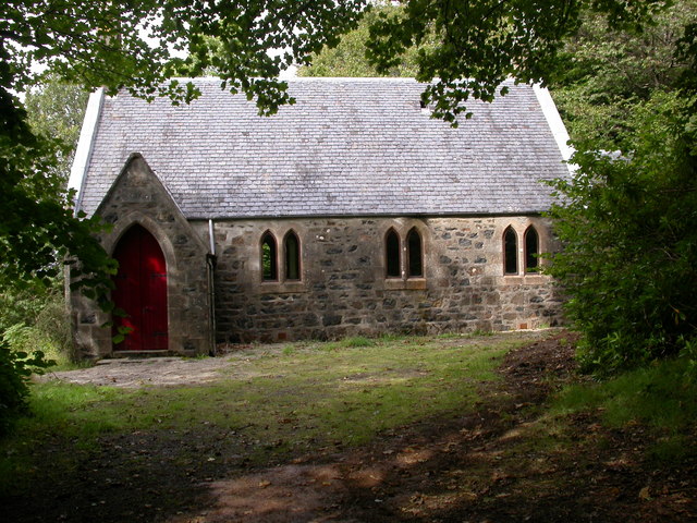
These routes are also reputed to have been coffin roads. The medieval parish church of Killlintag (Cill Leuntaig), dedicated to St Fintan, was located near Mungosdail just to the east of Bunavullin. The burial ground is still marked on current OS maps, but the church is reduced to its foundations. It was replaced in 1780 by a new building at Fernish to the south. This was itself superceded by the mission church built in 1892 for the western side of Morvern parish - this former Church of Scotland building can be seen in our picture gallery. Additionally, a Roman Catholic church, the Chapel of St Columba, was built in 1837 at Drimnin. However, the graves to the south of the chapel are modern.
The track from Ardantiobart to Bunavullin is clearly marked on all the OS mapping since the 6" first edition maps were surveyed in the 1870s. Interestingly, by the time of the OS 1" third edition map surveyed in 1905, a spur runs from the track (NM5853) down to Druim na Cracaig where the later Fernish churches were built.
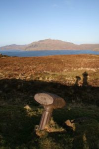
St Columba's Stone (NM 5945 5428) provides evidence for the former use of the track from Loch Teacuis as a coffin or kirk road. It is said to have been one of a series of stones marking this hill track, and it lies on the highest point of the route giving its name to the hill to the north - Crois Bheinn (Cross Peak). The stone has a cross on each side and measures 0.61m by 0.51m. Its site is marked on the OS 1:25,000 Explorer 383.
Further evidence for a series of stones marking the route has been found on a 1:10,000 map with two stones marked near where the right of way leaves the forest before reaching St Columba's Stone and another two stones marked beside fords (NM591541 and NM585534) within the forest. This route between Drimnin and Barr is also said to have seen use as a post-track - the post being left beneath a rock at the pass between the forest and Coire Buidhe. So whether the stones in the forestry date from the track's use as a coffin route, or were placed to aid the postal service, we are not certain. Any photos or further information relating to the stones would be much appreciated.