Greenock Cut Show path on map
Start location: Waterman's Cottage, Overton Road, Greenock ( NS 266 748 )
End location: Greenock Cut Visitor Centre ( NS 247 720 )
Geographical area: Strathclyde and Lanarkshire
Path type: Industrial Path, Leisure Path
Path distance: 8km
Accessibility info: Suitable for bikes, Suitable for Motorised wheelchairs, Suitable for pedestrians
Route Description
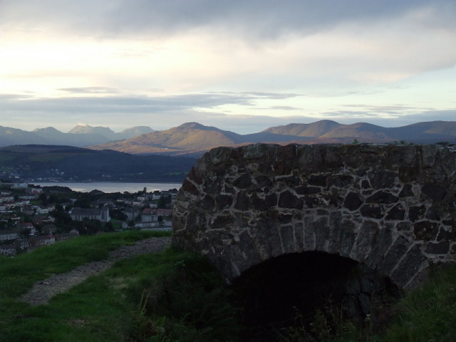
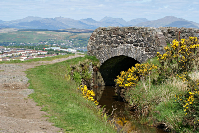
The Greenock Cut is a former aqueduct with embankment serving as a walkway. It follows the contours of the hillside, mainly overlooking the town and the magnificent scenery of the Firth of Clyde and beyond to the Argyll hills and the “Arrochar Alps”.
Our route description starts at Overton as this is more easily accessed by public transport. From the steep Overton Road car park, a fine gravel ramp leads up to the aqueduct. An openable metal kissing gate provides access to the embankment eastwards. The surface is basically grass grown hardcore/gravel wide enough for two to walk abreast. Follow the Cut all the way to Shielhill farm (NS241721), where the road is crossed before following the path to Cornalees Bridge and the Greenock Cut Visitor Centre where there are toilets, a cafe & picnic facilities.
From here, there are two good alternatives to heading back the same way. Either, take the Waterman’s Road which is a path creating a more direct, if significantly less-level, route back to Overton – it is recommended to do this combined circular walk anti-clockwise to enjoy the scenery. Or continue to Wemyss Bay, using the Kelly Cut.
There has been a lot of work done on the Greenock Cut, and most of it is reportedly accessible to mobility scooters.
OS Landranger 63 (Firth of Clyde area)
Heritage Information
The Greenock Cut is an aqueduct built between 1825 and 1827 to supply water from Loch Thom to the mills and population of Greenock. It was built by Robert Thom, after whom the expanded Loch was re-named, and is a very early example of its type. The visitor centre has an interactive Greenock Cut exhibition that explains Thom’s 1820’s engineering. In 1971, the aqueduct was superseded by the Loch Thom Tunnel; the following year it was designated as a Scheduled Monument.
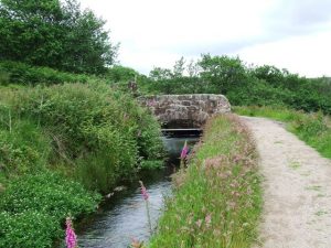
The aqueduct has a lot of associated historic features to look out for along its length, such as two watermen's bothies, stone waster sluice houses and distinctive hump-backed bridges - of the latter, there were reportedly originally 22, but are they all still in situ?! The visitor centre website's downloadable walk leaflet is recommended, as it provides additional historic and natural heritage information.