Loch Bhac Shieling Path Show path on map
Start location: A9, south of River Garry ( NN 839 657 )
End location: Old Struan Coffin Road, southwest of Loch Bhac ( NN 817 618 )
Geographical area: Perth, Kinross and Stirling (part)
Path type: Military Road, Rural Path
Path distance: 4.6km
Accessibility info: Suitable for pedestrians
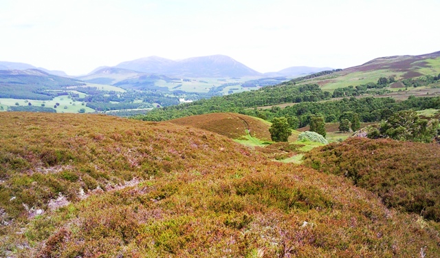
Route Description
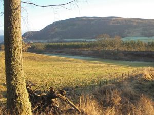
Balnansteuartach near the north end of this route is directly approached by a right of way from the A9, but it is difficult to safely access this unless dropped off at the road end. A9 dualling works should eventually improve matters, but until these are complete, we suggest approaching this old route from Blair Atholl. Cross its footbridge over the River Garry, then ascend to the A9. Cross with great care, then ascend and bear right on a track to Balnansteuartach. This start adds 3km to the route.
From Balnansteuartach, go south up a path on the west side of the Allt Bhaic, then southwest uphill towards the site of former shielings at NN625631. Either return from here, or follow the continuation of this old route past the west side of Loch Bhac to meet with the Old Struan Coffin Road at NN817618, which can be followed south to Loch Tummel.
OS Landranger 43 (Braemar & Blair Atholl)
Heritage Information
This track was most recently used to access the shielings north of Loch Bhac. However, it has an older provenance being shown as a road on Stobie's map of Perthshire in 1783, and on a map of 1725 (in the British Library) as part of the road between Inversnaid Barracks and Ruthven Barracks near Kingussie. The route from Inversnaid was by Stronachlachar, the head of Loch Katrine, the north side of Loch Voil, Balquhidder, Lochearnhead, northeast to Loch Tay and Kenmore, the west end of Loch Tummel, Blair Atholl, thence north by the Minigaig Pass.