Kirkton of Glenisla Coffin Road Show path on map
Start location: unclassified road, north of Kilry Lodge ( NO 233 550 )
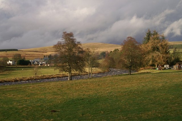
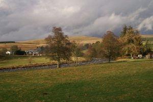
End location: B951, Kirkton of Glenisla ( NO 212 603 )
Geographical area: Angus and Tayside
Path type: Coffin Road
Path distance: 5.5km
Accessibility info: Suitable for pedestrians, Survey required
Route Description
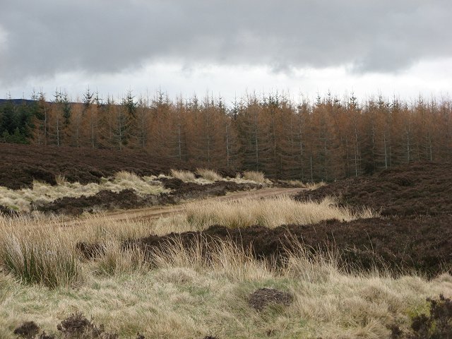
The first kilometre of the Coffin Road coincides with the Cateran Trail; it follows a tarmac road serving a number of houses and Loanhead farm. Just after Loanhead, this old right of way diverges from the Cateran Trail – a gate gives access to a grassy path leading up the hill. It crosses a stone track (gate each side) then continues as a grassy path up Broom Hill. Trees have recently been planted over much of the hill; there is a broken gate at the start of an older, but still recent, plantation, through which the path is more distinct, until it reaches a fire look-out and crosses a new track (shown on latest maps). The path is less obvious beyond this track, but the line can be seen while descending to the look-out. After another broken gate, the path becomes very wet underfoot, but is easily followed to the end of the wood where there is a high gate, easily opened. The path continues clearly defined over open moorland, then after another gate follows a dyke to a small wood. The map shows the path diverging from the wood at the southern end, but the gate is adjacent to the wood. On the hillside down to Glenisla the path is somewhat intermittent, but the Cateran Trail is rejoined just before reaching a suspension footbridge*. On the other side of the river a gravel path leads to the road.
*As of November 2021, the footbridge is closed. For the time-being, on Cairn Hill where the Coffin Road meets the Cateran Trail, you can get to Kirkton of Glenisla by following the CT generally eastwards through Whitehill Wood to reach Whitehills and then using the CT diversion from Whitehills.
OS Landranger 53 (Blairgowrie & Forest of Alyth)
Heritage Information
Local tradition has it that this path is an old coffin road. As such people would have to have carried their dead from wherever they died (which could be a very long way away) to the church at Kirkton of Glenisla. As this route involves an ascent over the top of Broom Hill it must have been some very strong and fit pall bearers who did it. There may have been some coffin rests along the way to give the carriers a rest and a drink, but none have so far been identified.
The suspension footbridge at Kirkton of Glenisla is a listed structure, built in 1824 by John Justice of Dundee. It is not yet known why it was built or even whether it replaced an earlier bridge, but this old route could be the reason for its existence. The church at Kirkton of Glenisla was built in 1821, replacing an earlier structure dating back to at least 1627, so it is possible there was a spirit of associated improvement around the 1820s. The New Statistical Account (1842) reported that since the previous Account the system of statute labour had been converted into money which was resulting in a steady improvement in the state of the roads, and that an iron suspension bridge had been thrown across the Isla. As the Old Statistical Account (1791-99) refers to only two bridges in the parish, but some funds having been raised towards another, it appears possible that the suspension footbridge was the result. In 2021, an engineer survey found that in addition to the bridge's timber joists and decking needing replaced, its iron work needs extensive maintenance. The bridge is thus currently closed for safety reasons, but it is hoped that funding will be found in order to secure its future use.