Tannadice Drove Road Show path on map
Start location: Tannadice Primary School ( NO 475 582 )
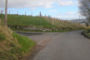
End location: unclassified road, Nether Balgillo ( NO 487 586 )
Geographical area: Angus and Tayside
Path type: Drove Road
Path distance: 1.3km
Accessibility info: Suitable for pedestrians
Route Description
The route starts at the entrance to the Primary School in Tannadice, a narrow tarred road with a wide pavement. Through the school gates a tarred path continues to the left of the buildings becoming a gravel track before passing through further gates to become a grassy track, fenced both sides: a field to the right; school playing field, then a field to the left. After a bit the path crosses a field as a wide swathe of short grass. It then becomes a grassy path between fences, possibly overgrown in summer; after a wood on the left it becomes a track with tractor ruts. The route can be wet or muddy in several places. Only the last 400 metres of this route is shown on the OS map.
OS Landranger sheet 54 Dundee & Montrose)
Heritage Information
This is a very small section of drove road and is thought to have been used by drovers getting their cattle to the Trynity Tryst. The Trynity Tryst was held annually on the Muir of Brechin and was a very important and very old cattle fair on the route from Kincardineshire to Perth.
