Old Road to Coignafearn Show path on map
Start location: Kingussie ( NH 756 013 )
End location: Coignafearn (Old Lodge) ( NH 710 179 )
Geographical area: Cairngorms National Park, Inverness, Nairn, Badenoch and Strathspey
Path type: Rural Path
Path distance: 24km
Accessibility info: Suitable for pedestrians, Survey required
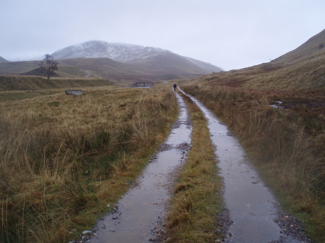
Route Description
This is a very long walk through the rolling hills and long glens of the Monadhliath. From the centre of Kingussie take the road up the east side of the Allt Mor through the golf course. At Pitmain Estate’s Gynack Lodge a diversion is in place – instead of crossing the burn here, continue for another 100m, where another bridge takes one across to rejoin the track north. The path carries on northwest by the track which goes to the top of Carn a’ Bhothain Mholaich.
Then go west-northwest – no path, difficult in mist – making a slightly rising traverse across three small streams flowing north west to form the infant Dulnain. A fourth stream flows out of a narrow grassy valley. Follow it upstream to a tiny lochan (which disappears in dry weather) and go over the col (760m) where there is a derelict boundary fence, to reach the Allt Glas a’Charbaid. Go down the east bank of this burn along an indistinct path to reach the confluence of a smaller stream with the Elrick Burn at NH687117. Ford the smaller burn and continue along a path beside the Elrick Burn, crossing to its west bank by a bridge downstream, hence joining another route just before reaching Coignafearn Lodge. Then join the path on the west bank of the Findhorn to Coignafearn.
OS Landranger 35 (Kingussie & Monadhliath Mountains)
Heritage Information
This is thought to be an old cart road, if so then it must have been very intrepid and persistent people who went by cart. Indeed there is little track left for walking these days and it is difficult to imagine carts travelling this way.
The route is marked as a road in Roy's map of 1755 and Roy tended to note only the important roads in his survey. As such it must have been significant and continues on from the north end of the Minigaig and the Gaick Pass, so could well have formed the northern part of a main artery linking the north with the south. It is more likely that this road would be used than Wade's route or the path of the current A9 as Coignafearn is a very historic site and the Slochd was a very difficult route to take, even after Wade had his road built.