Balfron Drove Road Show path on map
Start location: A875, north of Balfron ( NS 546 896 )
End location: A811, Gaisland ( NS 534 908 )
Geographical area: Campsie Fells, Stirling, Clackmannan and Falkirk
Path type: Drove Road
Path distance: 1.75km
Accessibility info: Suitable for pedestrians
Route Description
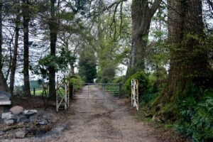
This right of way starts as a tarmac road to a house called ''The Rinnans'' at which point it becomes a distinct footpath, running along the north-east side of a fence and passing through several pastures. At NS 536 906, the path becomes a farm track up to the A811 road, just north-east of Gaisland. Our surveyor reported that there were no difficulties anywhere along the path and all gates were easily opened where required.
OS Landranger 57 (Stirling & The Trossachs area)
Heritage Information
This right of way is locally thought to have been a drove road, possibly avoiding tolls at Balfron.
