Spout of Ballochleam Show path on map
Start location: Ballochleam road-end, Glinns Road ( NS 656 927 )
End location: unclassified road, Cringate, Carron Valley ( NS 684 865 )
Geographical area: Campsie Fells, Stirling, Clackmannan and Falkirk
Path type: Rural Path
Path distance: 8.3km
Accessibility info: Suitable for pedestrians, Survey required
Route Description
Although this old route starts at the Ballochleam road-end, a suggested largely off-road approach to it starting in Kippen is first described; this adds 4km to the given distance.
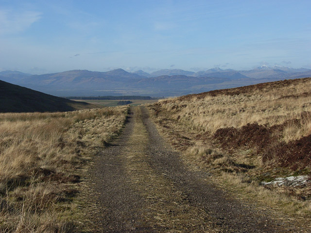
Starting in Station Road in Kippen, turn southeast at the war memorial along Burnside. Continue beyond the national speed limit sign and turn to the right directly before the row of houses at Glentirranmuir. After 100m or so take a left turn (east) and follow this track over the Dasher Bridge until you reach the Glinns Road. Go southwest along this road for around 1km till you get to the turn-off for the Spout of Ballochleam at NS656927.
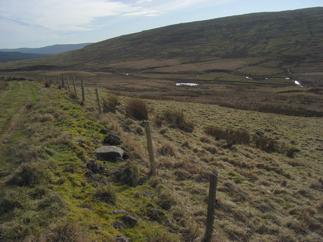
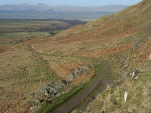
Follow the Ballochleam farm access track, but don’t turn right to approach the farmhouse. Instead, continue south along the farm track. There is an openable gate across the track and from here follow the Boquhan Burn up to the Spout of Ballochleam. The route then continues along the track in a southeast direction. There is a ford crossing Gourlay’s Burn, then follow a well defined track to Burnfoot Farm, which is now a ruin. From the farm, the route (no path) heads southeast to cross the Burnfoot Burn where the Heritage Paths (Campsie Fells) project built a bridge alongside the ford, so crossing is no longer difficult. Again, there is no defined path from the burn east for a couple of hundred metres until you meet the Earlsburn windfarm track. Follow this south until you get to the bridge over the Endrick Water; there is then a choice of routes.
Either, stay to the east of the Endrick, heading towards the ruined Cringate house’s access track and enter the plantation at NS684867; the route’s end is on the minor road north of Sir John de Graham’s Castle. Or cross the Endrick and follow the windfarm road until it meets the B818 at the Todholes road-end (NS672859). The latter is a much easier route, but the former follows the historic line more closely.
OS Landranger 57 (Stirling & The Trossachs area)
Heritage Information
Grassom's 1817 map clearly shows this route running from the north as far as Burnfoot. Backside is marked where the sheep enclosure lies today and Gourlay's Burn is labelled as the Endrick Water. This through route to the Carron Valley has been appearing in the Scottish Hill Tracks book since its first edition in 1947 - described variously as then continuing to either Kilsyth via the Laird's Loup route or to Queenzieburn via Johnnie's Dam Path.
A route up to the Spout of Ballochleam will have been of use for many years. The First Statistical Account for Gargunnock (1795) states: "The cleft of Ballochleam is still remarkable for the hawks, for which it was in great request in former times, when falcolnry was in fashion". By 1841, at the time of the Second Statistical Account, the fashion seems to have come around again as it is reported that: "The hawks build their nests on the almost inaccessible cliffs of Ballochleam. These are the falcon hawks; and gentlemen in several parts of England have sent repeatedly to take their young, for the purpose of taming them for hunting".
The route also has the local reputation of having been a drove road.
In addition to the building of the Burnfoot bridge as mentioned above, the Heritage Paths (Campsie Fells) project produced a lovely Campsies map leaflet showing this old route and other paths in the area. Along with a range of leaflets, the ScotWays website has this map available as a free download or paper copies can be posted out via the webshop (P&P applies).