Bargrennan to Polharrow Bridge Show path on map
Start location: Bargrennan ( NX 349 764 )
End location: Polharrow Bridge ( NX 603 842 )
Geographical area: Dumfries and Galloway
Path type: Rural Path
Path distance: 39km
Accessibility info: Suitable for pedestrians
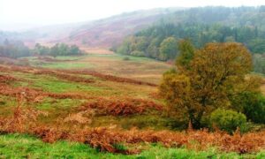
Route Description
This is a long and, at times, complex route through rough and often remote ground with ongoing forestry operations. The description below does not always exactly follow the mapped line, but is the one for which Heritage Paths has received survey information; further updates are welcome.
From Bargrennan, follow the Southern Upland Way for about 5km to Caldons at NX397790. Turn north to cross the Water of Trool and go up Glen Trool on the north side of Loch Trool, past the Bruce Stone to Buchan. From here, take the path east-northeast up the hillside to the Gairland Burn, and ascend beside this to Loch Valley. Beyond this loch, go northeast around the east side of Loch Neldricken, then north for 1km, and turn east over the ridge between Craignaw and Dungeon Hill to the Round Loch of the Dungeon. To avoid the dangerous Silver Flowe bog on the south side of this loch, go round its north side, taking care to find sound footing across the boggy ground. Follow the forest boundary southeast to NX474842, where the route meets the ride at the edge of the forest leading to Backhill of Bush bothy (non-MBA, NX480842). From the bothy, follow the forestry road north-northeast for 800m along the Loch Doon Road (another Heritage Path), leaving it by turning right at the junction NX483850 (initially southeast) and continuing along the road for another 1.5km to NX496847. Go initially east directly up a rough zigzagging path to cross the ridge at the col 1.5km south of Corserine at NX502855 (628m). Descend steeply east-southeast over very rough grass and heather to NX514852, where there is a footbridge across Hawse Burn (above the waterfall). Once across, go downstream around the edge of the forest to find the firebreak and go east to reach a stone memorial at NX515852. Follow the forest road east to cross a footbridge at NX527850 and on to a junction at NX534853, turning left (north) towards Loch Minnoch dam. At the dam, cross via the ford and continue east then northeast, following the road via Burnhead until a car park and the start of a minor public road at Burnhead Bridge (NX553862). Continue east along the minor public road for a further 6km to Polharrow Bridge, 3.5km from St John’s Town of Dalry by the A713.
