Ardtalnaig to Comrie Drove Road Show path on map
Start location: just south of Coishavachan ( NN 742 272 )
End location: Ardtalnaig ( NN 701 392 )
Geographical area: Perth, Kinross and Stirling (part)
Path type: Drove Road
Path distance: 16km
Accessibility info: Suitable for pedestrians
Route Description
Our route description runs from south to north. Starting from Comrie adds an additional 7km to the route, or there is a parking area (NN742273) near Coishavachan which can be busy.
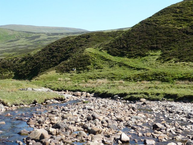
A quiet public road runs from Comrie up Glen Lednock to Coishavachan. From there, continue north along a track, then path, on the west side of the Invergeldie Burn. The burn turns north, and the path crosses to reach a track on the east side; follow this north up it to its end. Continue north-northwest up to the bealach (633m) by a boggy and indistinct path which loses itself in the peaty terrain. Descend northwest across the grassy hillside (no path) to cross the River Almond (no bridge) to the low three-way ScotWays signpost just east of Dunan near the head of Glen Almond. This section is featureless and in bad visibility a map and compass are essential, particularly if doing this route in reverse and climbing from the river towards the bealach. From Dunan go north by a rough road over the watershed and down Gleann a’ Chilleine to Ardtalnaig.
OS Landranger 51 (Loch Tay)
Heritage Information
This old route has the reputation of being a former drove road. These days, part of it is used by the Ardtalnaig to Amulree alternative section of the Rob Roy Way, a long-distance route from Drymen to Pitlochry.