Rona Path Show path on map
Start location: Port an Teampuill ( NG 616 543 )
End location: Shielings, Dry Harbour ( NG 622 581 )
Geographical area: Skye and Lochalsh
Path type: Coffin Road, Rural Path
Path distance: 4.5km
Accessibility info: Suitable for pedestrians
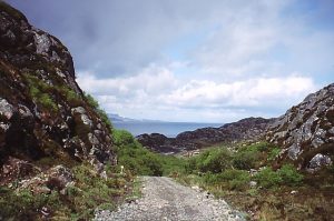
Route Description
We don’t yet have a survey of this route and would be very grateful to receive one.
OS Landranger 24 (Raasay, Applecross & Loch Torridon)
Heritage Information
This path runs right through the centre of Rona and would have been used for a variety of purposes.
There are a number of townships on Rona such as Doire na Guaile (NG619549) and Acairseid Thioram (NG623582), which were heavily populated in the mid 19th century after mass evictions on Raasay. It is thought that at this point the island's population was around 400. This path passes both townships and terminates at the southern end at the old church, An Teampull.
People must have walked this track frequently to communicate with others living on the island, and to carry their dead to be buried at the graveyard to the south. It is also said to have been used by the postie who crossed from the north of Raasay in order to continue his deliveries. For more detail on this, see http://www.heritagepaths.co.uk/pathdetails.php?path=316.
