Ca na Catanach Show path on map
Start location: Dorrery Lodge ( ND 074 549 )
End location: North of Achentoul ( NC 877 368 )
Geographical area: Caithness, Sutherland
Path type: Drove Road, Medieval Road
Path distance: 35km
Accessibility info: Suitable for pedestrians, Survey required
Route Description
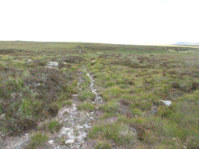
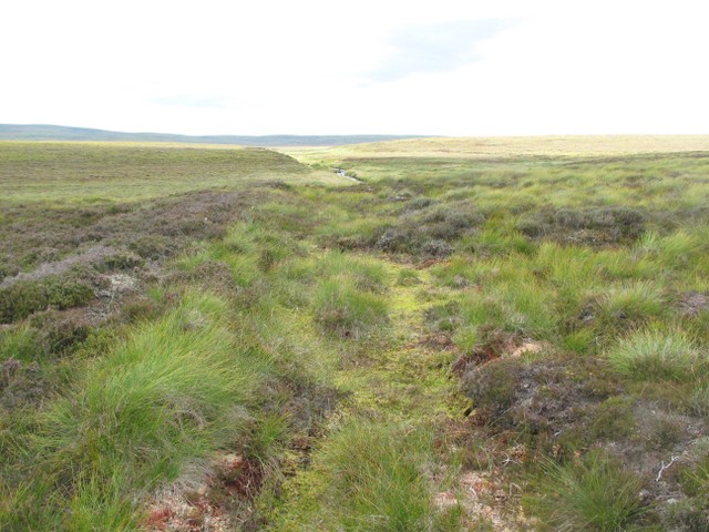
This is a challenging, but rewarding, route through remote country in the heart of the Caithness peatlands. Parts are in good condition and easily followed, but some sections are faint or untraceable, so require careful navigation to stay on course. There are two river crossings which might be unsafe in spate conditions and there are deer fences to be crossed. Note also that the central part of the route splits into two separate ways, one taking a direct line across the peatlands and the other going by the remote former settlement of Rumsdale, These two strands meet again on Cnoc na Gall, but before the end at Achentoul is approached, the old route again divides into two roughly parallel ways.
From Dorrery, take the estate road which bypasses Dorrery Lodge. This road forks at a cattle shed, here take the right hand branch which leads to Ben Dorrery. At ND066545, the Ca na Catanach leaves the Ben Dorrery road, instead continuing west as a shallow channel in the peat. Follow the Ca to the house at Torran. From here, the Ca descends to the Torran Water which cannot now be forded, the level of Loch Shurrery having been raised. Instead follow the estate road to cross the river at a bridge (ND056537). At ND052537, the Ca na Catanach can be seen emerging from the flooded ground to merge with the estate road.
Continue southwest on the estate road which lies over the Ca except for a few sections where the old road can be seen running alongside, notably beside some trees near the ruin of Cnoc-glas. At ND032516, where the road enters a narrow glen, the Ca leaves the road on the north side and runs above it for 1km before rejoining it just before Loch Caluim.
Cross the bridge over the Loch Caluim outlet and follow the west bank of the Cnocloisgte Water to the remains of a footbridge (ND023508). Ford the river and ascend an obvious ramp. The section which follows is the best preserved part of the Ca. After crossing the Allt Clais nan Lair at ND017493 the path fades in wet ground, but is easily picked up at ND015490 and climbs to the watershed before entering a forest through a gate (ND009483).
The path now follows the shore of the Skyline Loch before entering a forest ride at ND009478. Follow the ride to its end where the faint path merges with a forest road (ND006473). At ND001468, just west of the bridge crossing the Allt nam Breac, the route divides. The right hand branch goes directly to Cnoc na Gall; the left branch goes by Rumsdale before rejoining the route. Note that the junction can not be clearly seen. Directions for both routes follow.
Direct Route by Cnoc na Gall:
Follow the forest road for 5.5km to NC969446. At this point the Ca na Catanach leaves the forest road and enters an area of conifers, now felled, before reaching a ride at ND965443 where it is clearly visible as a grassy channel. After crossing a tributary of Allt a’ Clair Loch, the path is obscured by short section of felled conifers before crossing a deer fence (NC960440). Navigation is now difficult through an area of peat hags, so it is best to head for the railway bridge (NC952435) which crosses the Allt a’ Bhadain Dubh. A walkway under this bridge enables the railway to be safely crossed.
The path becomes clear 100m southwest of the bridge and the route ahead can be seen climbing the shoulder of Cnoc na Gall. After crossing a deer fence at NC943431 the junction with the Rumsdale branch is reached at the head of a small burn NC934425.
Route by Rumsdale:
At ND001468, leave the forest road and enter a curving ride through which the path is faintly visible before it merges with another forest road at ND000463. Follow the forest road over a level crossing and past Badnaheen until a gate is reached at Clach Seasaimh, a small cairn (NC997429). The path now enters the open hill and is obvious up to NC992425, but then intermittent until the Rumsdale pasture is reached (NC987413).
After passing the old settlement of Rumsdale, the route follows the north bank of the Rumsdale Water, initially as a landrover track. After NC980407, the path fades, but becomes clear at NC971412 and is easily followed up to NC963412 where it disappears for about 1km before becoming visible again at NC957415. After a deer fence at NC939424, the junction with the direct route is reached at NC934425.
The two routes now reunited, proceed southwest to Baledigle forest entering a ride at NC932424 and continue to NC925419. The path becomes very uncertain for about 800m in a complex area of intersecting rides and it is best to navigate to NC920416 where it becomes visible again, continuing through NC915414, crossing a burn at NC915414 and reaching the Halladale River at NC913413. After crossing the river, the route crosses an unplanted area before entering the trees beside a small boulder at NC910412, then emerging into a ride at NC909411. The path is now clear, crossing a forest road at NC906409 and continuing to the crossing of the Bealach Burn at NC901403. This is the location of the former junction with a branch to Forsinard, which can be seen leading north as a forest road.
A deer fence is now crossed and the ascent to Am Bealach begins. The summit of the pass is reached at NC901403. If desired the route can be left at this point by climbing to the radio mast on Meall a’ Bhealaich and descending the access road to reach the A897 at NC884405 where a vehicle can be left. Alternatively, at Am Bealach the route divides:
– The easterly branch (which is probably the older route) is faint at first, but becomes clear at NC899394, crossing a burn at NC899390 and passing the remains of shielings at NC900386. The path fades just north of another shieling group (NC902374) at the Gable Burn, but the line can be followed to the abandoned settlement of Knockfin (NC899358). A direct continuation to Achentoul is possible from here, but there is no visible path.
– The westerly branch from Am Bealach may have been created by drovers after Knockfin was cleared of people. From the summit of the pass, the path is a broad channel which enters a conifer plantation at NC899398. Skirt the plantation and pick up the track where it leaves the trees at NC892388. The path soon becomes intermittent. Cross the Allt na Muic at NC891384, then the path becomes more obvious at NC891377 and continues to NC 8895 3677, just north of Achentoul, after which it is not visible. Therefore at this point it is recommended to either walk west to the A897, or east to meet the Knockfin branch and return to Am Bealach on that path.
Heritage Information
The Ca na Catanach is a remarkable survivor from an age when the only land routes in the north were the old ‘ways’ created by the passage of travellers on foot or horseback. Its early history is obscure but it is likely that Earl Rognvald was taking this route to hunt in the Ben Griams when he was killed in the fight at Forsie in 1158. Later it was probably used by the Clan Gunn to carry their dead ‘chiefs and principal men’ from Kildonan to their burial at the Chapel of St Magnus at Spittal. The branch to Rumsdale passes the site of another early chapel, dedicated to St Ciaran.
The Ca was also used as a way to the shielings. In the droving era, it became the northernmost part of the drove road which led from Caithness to the Dornoch Firth and further south. Later still, estate tracks and forest access roads were created over some sections of the route.
The road continued to Thurso, but the section north of Dorrery was greatly affected by the agricultural improvements of the 19th century. Although parts of this section can still be found, it is not at present a viable continuous route, so has not been included here.