Hartfell Spa Path Show path on map
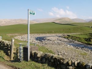
Start location: Unclassified road south of Newton ( NT 075 104 )
End location: Hartfell Spa Chalybeate Well ( NT 097 116 )
Geographical area: Dumfries and Galloway
Path type: Industrial Path
Path distance: 2.5km
Accessibility info: Suitable for pedestrians, Survey required
Route Description
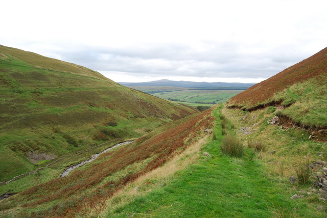
From the OS first edition 6″ mapping it can be seen that this path originally started along the south bank of the Auchencat Burn, shortly fording it. This path follows the north bank of Auchencat Burn to 095 114, then follows the course of a tributary stream to the well.
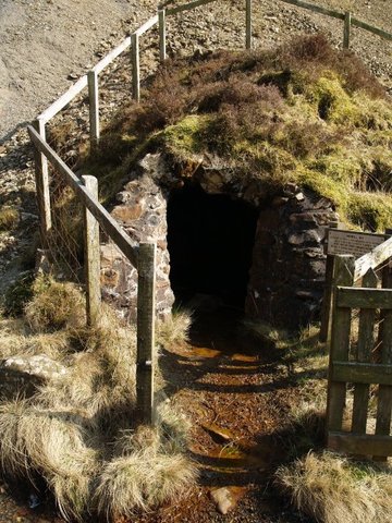
From the kissing gate at the start of the route, follow the side of the Auchencat Burn. The path goes up through fields, across a small but clear settlement. Where the path leads onto hill land, the old route via the river is now difficult to follow – steps down to the river still exist, but the 2 bridges to cross the river and back look very tricky. The low level path is indistinct in places. A better route is to follow a clear track heading up hill, which then levels out and heads across the slope coming out a short distance below the spa. The well head was empty when we were there.
OS Landranger 78 (Nithsdale and Annandale)
Heritage Information
The chalybeate (iron rich) spring of Hartfell Spa was discovered in 1748 by John Williamson, who was leading a mining operation by Auchencat Burn. This spring water had curative properties for "debility and anaemia". Unlike the sulphurous water from Moffat Well this could be bottled and was sent as far afield as the West Indies.
An "Old Copper Mine" is marked on the OS first edition 6" map of 1861. The Royal Commission of Ancient and Historical Monuments records copper mining activity by the Auchencat Burn and at Well Rig, and it is speculated that these may be the copper mines of Mr Grampton (Granton) referred to by Bishop Pococke in 1760. The slopes below Hartfell seem to have been a hive of activity in the eighteenth century, the quiet path of today will once have been very busy.