Glen Ey – Glenshee track Show path on map
Start location: Spittal of Glenshee ( NO 110 699 )
End location: Inverey ( NO 089 893 )
Geographical area: Cairngorms National Park, Perth, Kinross and Stirling (part)
Path type: Rural Path
Path distance: 24.5km
Accessibility info: Suitable for pedestrians
Route Description
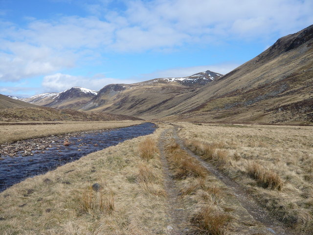
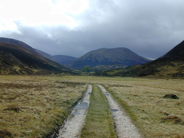
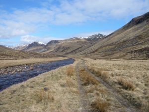
From Spittal of Glenshee take the track starting on the east side of the stone arch bridge taking the old A93 over the Shee Water. Follow it northwest then north up Gleann Taitneach on the east side of the burn. At NO076760, where the vehicle track turns left to ford the burn, instead take the path continuing up the east side of narrowing glen to Loch nan Eun, a high and lonely place surrounded by the rounded hills of the Mounth.
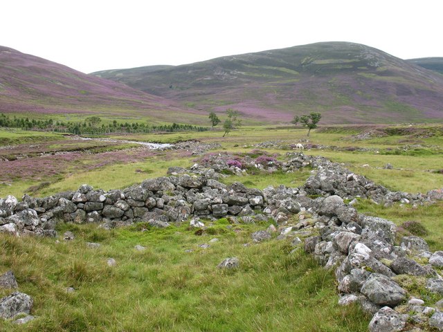
Go round the east side of the loch, which is at the watershed. The faint path line disappears, but descend northeast then north along the Allt Cac Dubh which merges with Allt Beinn Iutharn at NO070803. Ford the burn here to find an occasional path on its west bank leading to the ruins of Altanour Lodge. From there a good track, crosses and re-crosses the Ey Burn, meandering across grassy haughs, before descending on the east side of the burn to Inverey.
OS Landranger 43 (Braemar & Blair Atholl)
Heritage Information
This old route doesn't appear in its entirety in old maps, but much of it is shown on the Ordnance Survey's first 6" to the mile (first edition, surveyed in the 1860s). Although there is not a through track shown on that map, there are a lot of ruined townships, buildings and enclosures marked along the line of this route. This indicates there were people living along the route at one time, but the track to and from these dwellings had long since disappeared by the 19th century. Interestingly though on that map, the location of the now ruined Altanour Lodge is marked as Alltanodhar Shieling which perhaps reflects changing land use following evictions earlier that century.
It may be that this hill route is very old - the possible presence of a medieval hospital at Spittal of Glenshee may support this. There is no contemporary documentary evidence for this hospital, but the place name 'Spittal' is often taken to indicate the presence of one such, catering for travellers in particular. It would make sense if this facility was located at junctions of paths and routes, which could suggest that this path was in use long ago.