Moine Path Show path on map
Start location: Unclassified road near south end of Loch Hope ( NC 458 507 )
End location: Kinloch Lodge road end, Kyle of Tongue ( NC 554 523 )
Geographical area: Sutherland
Path type: Rural Path
Path distance: 18.5km
Accessibility info: Suitable for pedestrians
Route Description
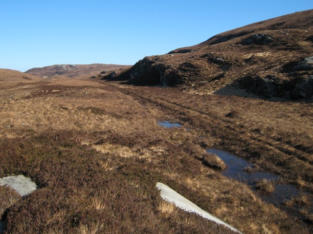
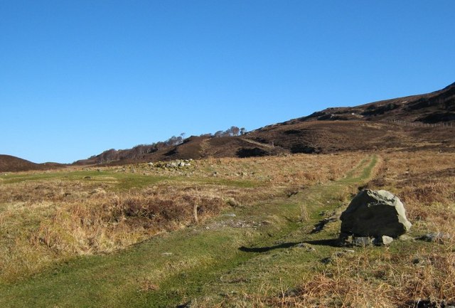
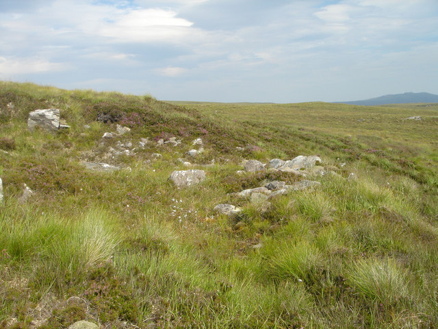
Apart from a short stretch towards the east end, the Moine Path is easy to follow. Its line is cut into the rocky slopes at either end, and on the higher plateau it is built up above the level of the bog, with ditches on both sides. The track was wide enough for carts, though heather has grown over most of the route leaving two parallel narrow grassy or stony lines, presumably thanks to occasional use by occasional estate vehicles. Most burns are bridged with stone ‘clapper’ bridges made of slabs of the local schist, some with two or three spans, though most are overgrown. Along the route there are many ‘borrow’ pits where stone was sourced to build the track.
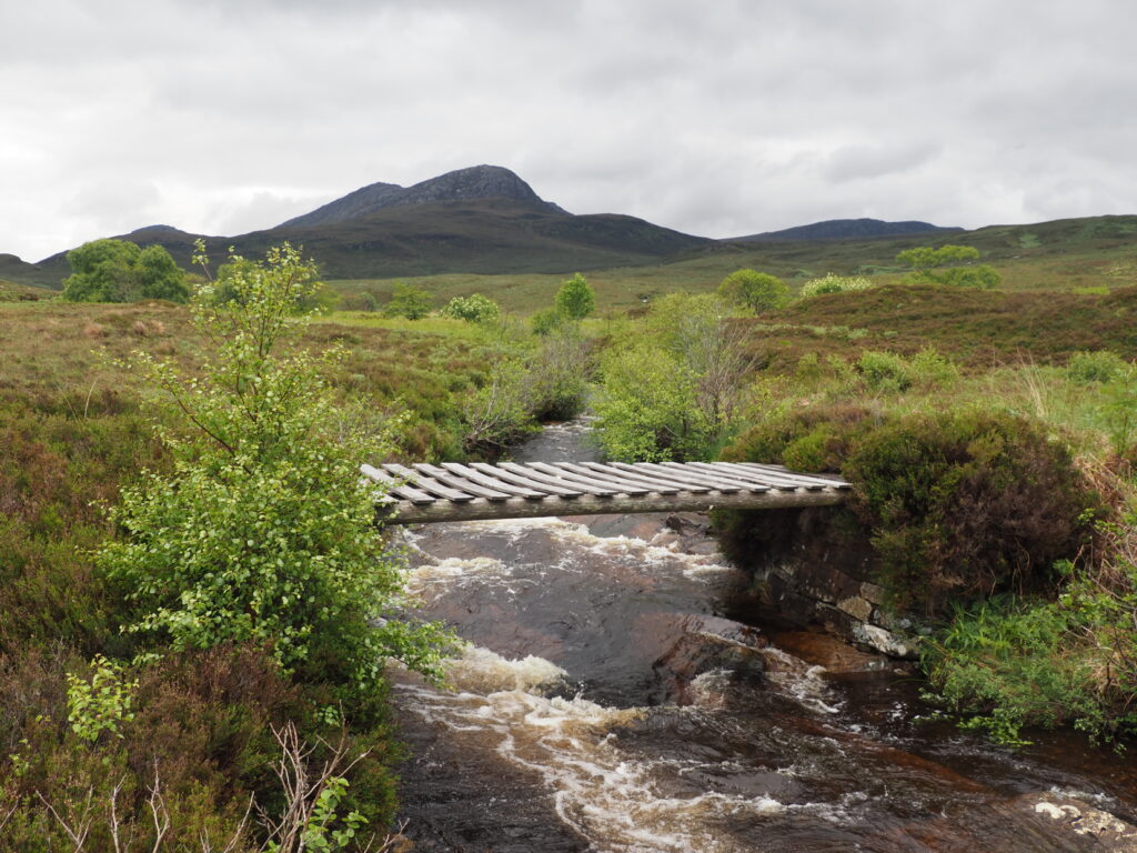
The west-end of the Moine Path starts at an unmarked point (NC459506) on the single-track Strathmore Hope road, at the south end of Loch Hope, 50m north of the bridge over the tree-lined Allt Dubh-loch na Beinne. There are a few possibilities for informal verge parking (don’t park in passing places). Follow the obvious grassy track which ascends north-eastwards. After passing through a regenerating birch thicket, the line of the track becomes very clear. The track passes a lochan then switches southeast to climb past a band of crags. At NC469523, cross a two-span ‘clapper’ bridge, this is the best example on the route. A second bridge is reached at NC473527: this one has a wooden deck in very poor condition*, resting on stone abutments. At NC479531, An Garbh-allt must be forded, this burn drains the whole east side of Ben Hope so may be problematic in spate.
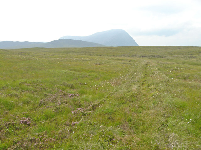
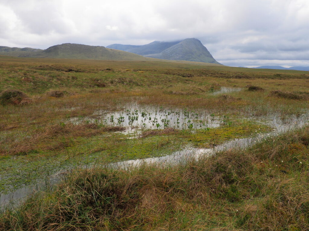
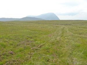
The route now climbs east-northeast onto the raised bog of A’Mhòine, with impressive views west over Loch Hope and south to the craggy north face of Ben Hope. For the next kilometre, the ditch on the right (south) side of the path has eroded into a deep gully of bare peat, leaving the track raised high above the level of the surrounding bog. It then continues northeast on a low embankment as the gradient eases onto the plateau, with pools and lochans scattered on the bog, and a post-and-wire fence roughly parallel to the north. At NC501543, a bridge has collapsed but the small burn can be stepped over.
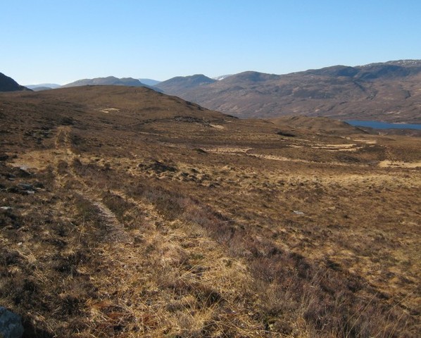
After passing the high point at 285m, the track descends gently, then more steeply as it turns southeast away from the fence. The landscape changes from uniform bog to shallower peatland with many rocky outcrops, and the dramatic castle-like summit of Ben Loyal comes into view to the east. A second simple wooden bridge, this one in good condition, takes the track over the Allt Ach’ an t-Strathain, then the route contours east-southeast to a low but distinct bealach at NC548525. From here, the line of the route becomes indistinct, but a faint grassy trod leads east-southeast through the bracken and gorse for 200m, to emerge at a T-junction of metalled tracks at NC550525 (if following the route westwards, leave the track at this junction and head west-northwest to reach the low bealach). Go straight across, southeast, following the track through scrubland, into woodland, to reach a tarmac estate road 50m south of Kinloch Cottage. Turn north past the cottage and exit between two stone pillars to reach a sharp corner in the minor public road around the Kyle of Tongue (at NC554522). There are some possible informal parking places 300m to the east, at NC557522.
OS Landranger 9 (Cape Wrath) & 10 (Strathnaver)
*In early 2026 we were informed that the landowner, WildLand, is planning a bridge replacement and path repair work.
Heritage Information
This path is something of a mystery. It appears in the first edition of Ordnance Survey's 6 inch to the mile series of maps, which was surveyed in 1874; it is also depicted by two parallel lines in Ordnance Survey's first one inch to the mile maps, surveyed in 1872. Therefore it is certainly an old track, as it was significant enough to be portrayed as a road on the 1" maps, and is supposed to be quite a wide track in places therefore perhaps formerly suitable for carriages.
The modern road (A838) which lies to the north follows the general line of a road built in 1830. A worn plaque is sited on the side of the now derelict Moin House, upon which once could be read words lauding the Marquess of Stafford for having the road constructed. This Marquess is probably better known as the notorious Duke of Sutherland. The plaque included the words: "This house erected for the refuge of the traveller was to commemorate the construction of the Road across the deep and dangerous morass of the Moin, inpractible to all but the hardy and active native; to him even it was a day of toil and of labour".
It could be concluded that the Moine Path was a road which initially developed as it was a more direct route than the later road, but one that was steeper and possibly more prone to being washed away. No date can be placed on the road although it has probably existed for centuries. It is thought to have been a drove road. Being less accessible than the road and not passing any habitation must have left the path without much traffic so it perhaps became somewhat ignored as the modern road network was being improved.
It is currently a very enjoyable walk though and is quiet with majestic views.