Roberton Drove Road Show path on map
Start location: A70, New Mains, northeast of Douglas ( NS 847 315 )
End location: (a) Newton, 12km (NS 937 316); (b) Roberton, 13km ( NS 945 286 )
Geographical area: Strathclyde and Lanarkshire
Path type: Drove Road
Path distance: 13km
Accessibility info: Suitable for pedestrians
Route Description
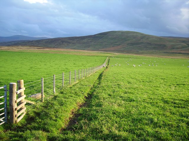
This old route starts at the cul-de-sac leading to the New Mains farm complex. Cut through farm to its southwest corner and identify the well-used tractor run, steadily climb southeast along the plantation perimeter fence for 600m to the top corner of Mainshill Wood before veering east-southeast for 1.2km passing to the north of Parkhead Hill and on to Parkhead Cottage. From here head south for about 1km along the B7078 (old A74), one carriageway of which is a cycleway.
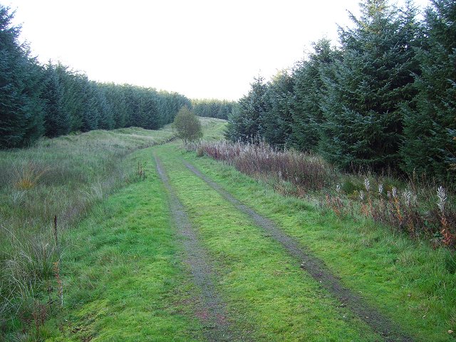
From the road end at NS864296, the cellular phone antennae can be seen to the northeast beyond the M74. The surfaced track goes under the motorway, then 100m after this under some large pylons. After another 90m, the track turns north-northwest for 500m still ascending the bottomed track. Just after the next bend southeast, take the first track on the right hand side which is grassed over. This bypasses both antennae masts on the west side. Continuing on the grassy track 50m beyond the antennae bear left (east-southeast) when after 110m the track leads to a comer of a fenced field on the left-hand side. Continue on the grassy track east-southeast then east to the top of a gentle rise. From this top, head roughly southeast soon regaining the landrover track heading towards a stand of fir trees at Birshaw Rig (332m). About 50m before the stand of trees, take the landrover track on the left heading east-southeast and after passing close to the trees, the track bears northeast for 225m. It then turns north for 100m where there is a sharp hairpin bend to the right. Take this now heading southeast and gently descending. After 230m from the bend a corner of a field fence is reached. Heading northeast the track now aims towards Tinto Hill ahead in the distance.
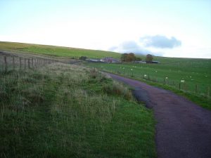
From here the landrover track is easily followed skirting the southeast side of Bodinglee Law, then crossing a burn 250m before Bodinglee Farm. Leave the farm track at the burn to pass through a field to reach the surfaced road just before a shed at NS903305. The narrow road is then followed to Fallside, where it is possible to proceed towards either (a) Newton farm and Wiston village, or (b) Roberton:
– (a) for Newton, simply continue proceed east-northeast along the narrow road.
– (b) for Roberton, follow the narrow road for 500m, then at NS914309 turn onto a track heading southeast eventually meeting a gate in the fence. Cross the burn and continue over rough grassland and heather until you reach this farm road’s end at NS932296. Follow the road southeast to Nap Bridge then Roberton.
Heritage Information
This track is said to have been used by drovers. It is depicted as a road in maps such as William Forrest's map of the County of Lanark of 1816, but by later that century it's been demoted to a footpath on the Ordnance Survey's 6" to the mile map.
Although on the above-mentioned older maps the route is more direct, it clearly made a steep ascent on the east side of the Parkhall Burn to approach Maidengill Hill. From modern mapping, it could be surmised that the detour to the M74 underpass is a diversion necessitated by the introduction of the motorway into the landscape. However, the OS maps this alignment as early as 1954 predating the new road, so it appears the longer more gentle detour by the service road was already preferred instead.