Gleann Cia-aig Drove Road Show path on map
Start location: B8005, Chia Aig bridge ( NN 175 888 )
End location: Tornacarry road-end, north bank of Loch Garry ( NH 193 023 )
Geographical area: Lochaber
Path type: Drove Road
Path distance: 18.1km
Accessibility info: Suitable for pedestrians
Route Description
Although this former drove road can be clearly seen on maps running south from Greenfield to Fedden, we have heard that it may be affected by forestry, so would welcome an update. In the meantime, to approximate this old route’s line of travel, we offer the following 20km south-north route description in part based on Scottish Hill Tracks which uses the rest of the historic route.
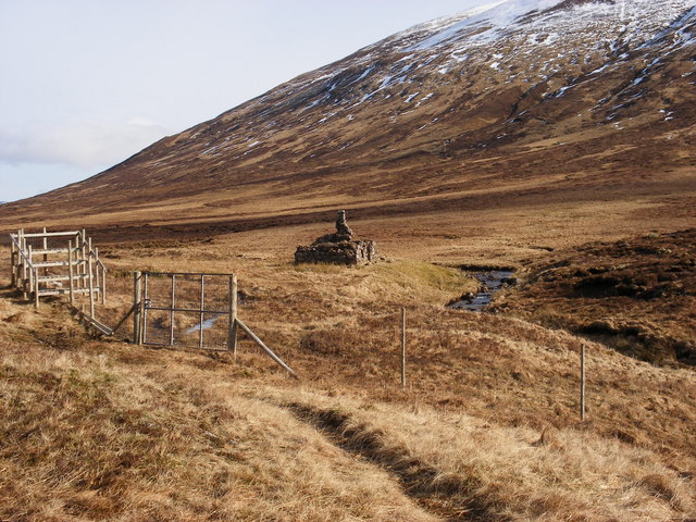
From the Eas Chia-aig waterfall carpark, follow the path (which becomes a track) on the east side of Gleann Cia-aig steeply uphill to reach a forest road. Go north along it to its end, continuing along a path through the forest. Going over a stile, follow the less obvious path to cross a bridge (NN187928) to the west side of the Abhainn Chia-aig. A very faint path continues northeast to the ruins at Fedden.
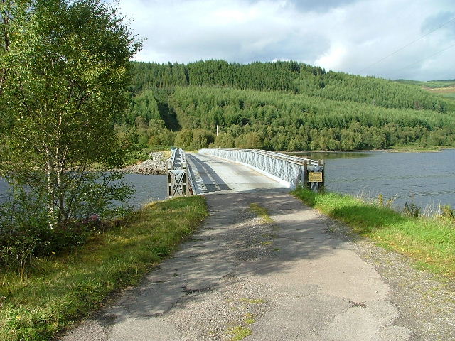
Instead of the historic route northwards from Fedden, cross the river and the floor of the glen northeast to reach an indistinct path which contours around below the western slopes of Sron a’ Choire Ghairbh. Head north, crossing a deer fence by a stile at NN204953, then north-northeast to the obvious forest entrance at NN207968. The path continues downhill, following the old fence line to a gate and a marker post. Turn right and follow a ride with occasional marker posts down to reach the Allt Bealach Easain at the end of the forest road down the Allt Ladaidh. Go down this road to its junction (NH230002) with the east-west forest road. Turn west here to reach Greenfield in 3km. From there, head north to cross the bridge (NH194020) over the narrows of Loch Garry, to reach the public road 4km east of Tomdoun.
OS Landranger 34 (Fort Augustus & Glen Albyn area)
Heritage Information
Two centuries ago, Fedden where a ruin stands today, was a much-frequented drovers’ stance. In the early 1930s although the cottage was derelict it still had a roof and windows.