Old Path from Cuaig to Arinacrinachd Show path on map
Start location: Unclassified road southwest of Cuaig ( NG 703 572 )
End location: Arinacrinachd School ( NG 744 582 )
Geographical area: Ross and Cromarty
Path type: Rural Path
Path distance: 4.8km
Accessibility info: Suitable for pedestrians
Route Description
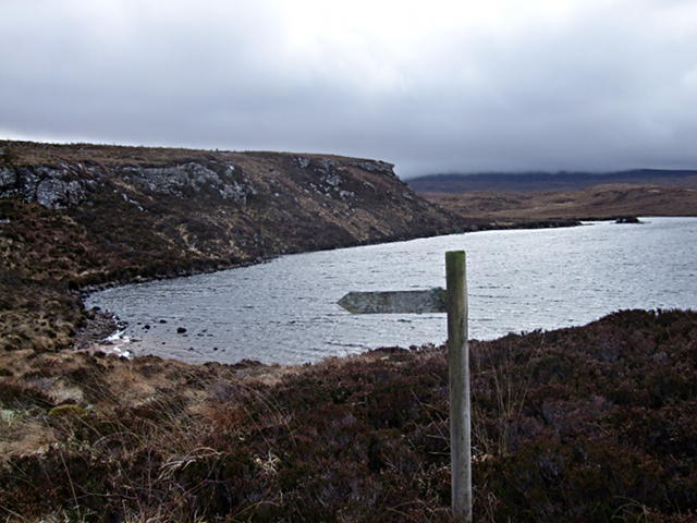
There are a few short sections of the old northern Applecross coastal path (now replaced by the road) which give pleasant short walks. Possibly the best of these is the old path from Cuaig to Arinacrinachd in the northwest corner of the Applecross peninsula. The route is cairned, but the path can be difficult to follow in places as it makes its tortuous way past several small lochans. Although the historic route’s eastern end is blocked by a small plantation, access to it has been improved by the Applecross Landscape Partnership‘s development of a link from the Arrina wood car park. This is a beautiful short walk, barely 5km, with wonderful views, especially if one makes a small diversion to the top of Meall Loch an Fhidhleir.
OS Landranger 24 (Raasay, Applecross & Loch Torridon)
Heritage Information
The north coast of Applecross didn't have a road until the present one opened in the mid-1970s. Until then the various crofting settlements were mostly supplied by boat, but the communities were interlinked by a footpath. It does not appear to have been a made path, instead the occasional stone cairns waymark a route which developed as a path between communities. Little used since replaced by the road, it was disappearing into the bog, but the Applecross Landscape Partnership sensitively restored it as part of a project to improve the accessibility and connectivity of its north coast path network, including also another section of the old path further east between Ardheslaig and Kenmore.