Kilmany Railway Line Show path on map
Start location: west side of lost railway bridge at Kilmany by Kilmany Grange ( NO 386 216 )
End location: southwest side of the old railway bridge near Rathillet Mill ( NO 360 214 )
Geographical area: Fife
Path type: Railway Track
Path distance: 3.5km
Accessibility info: Suitable for horses, Suitable for pedestrians
Route Description
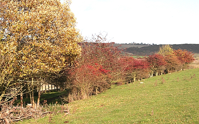
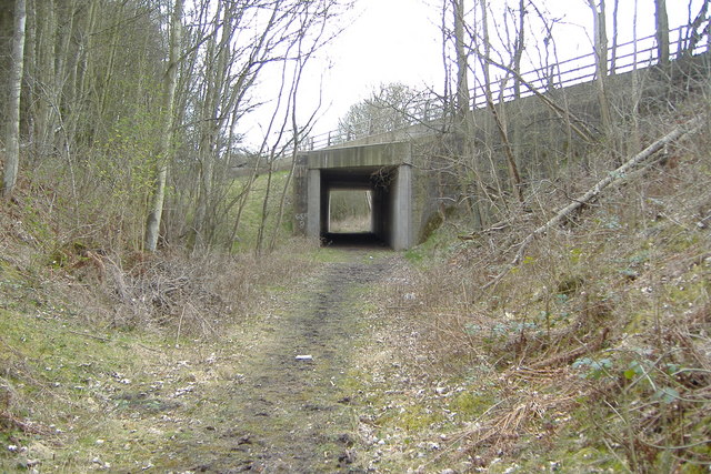
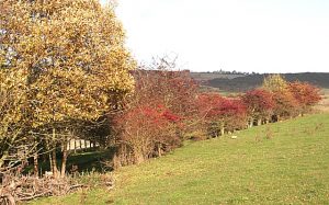
The start at the Kilmany end is on the west side of the "axed" railway bridge at Grid Ref 387 217, where a narrow earthy path leads up from the road onto the trackbed of the old North Fife line. Hoofprints indicate regular equestrian use and there is some suggestion that the route is strimmed. Heading westwards, there is a children’s playpark on the right / north initially, followed by a small group of houses, which are passed on their south side. The railway track narrows into a wooded cutting and passes under the A92. The onward route is never in doubt, the line being either in cuttings or on embankments, all vegetated. Despite the worn line of hoofprints, the encroaching vegetation needs mechanised action, the whole length of the route being too much for manual remedies. The one-time bridge over the minor road at Grid Ref 372 220 is now gone, and the route dips down to the road and up again. The going is as before, with some clear stretches, some encroaching vegetation but never any serious impediment. Circa Grid Ref 364 218, a fence (climbable) crosses the route. At the next minor road (Grid Ref 360 214) the bridge over the road is still in place, though the route ends just a few steps beyond the bridge, and a short, steep path descends the left / south side of the embankment to the public road. From this spot, the A92 and Rathillet are about a kilometre away.
OS Landranger sheet 59 (Perth & Alloa, Auchterader) or sheet 54 (Dundee & Montrose)
Heritage Information
This path is a small part of what was the Newburgh and North Fife Line, which formed a link between Newburgh and Dundee. The railway line opened in 1909 and was used by passengers only for forty years until passenger sevices were stopped in 1959 for and freight in 1962. The track was then dismantled two years later.
One of the bridges was intended to be demolished to facilitate the transit of heavy tractors. It would be understandable if the bridge in question was the bridge at the west end as, judging by the amount of damage to the underside, it must be difficult for high vehicles to pass underneath, but hopefully this will not come about because it is a beautifully constructed bridge.