Maiden Causeway Show path on map
Start location: Rowantree carpark, Maiden Castle ( NJ 692 245 )
End location: Mither Tap ( NJ 683 224 )
Geographical area: Grampian
Path type: Medieval Road
Path distance: 2.6km
Accessibility info: Suitable for pedestrians
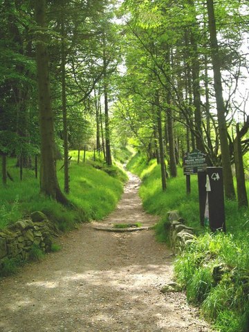
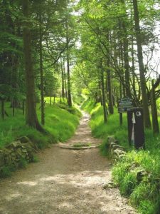
Route Description
From the Rowantree Car Park runs the ‘tourist route’ to the Mither Tap of Bennachie. It is looked after by the authorities and the Baillies of Bennachie. Consequently, it is well sign posted and well maintained. The route commences at the car park and consists of a pedestrian track that goes all the way to the top of Bennachie. It is a surfaced track consisting mainly of gravel and rocks. The Maiden Causeway largely follows the line of this route until well up the hill.
OS Landranger 38 (Aberdeen & surrounding area)
Heritage Information
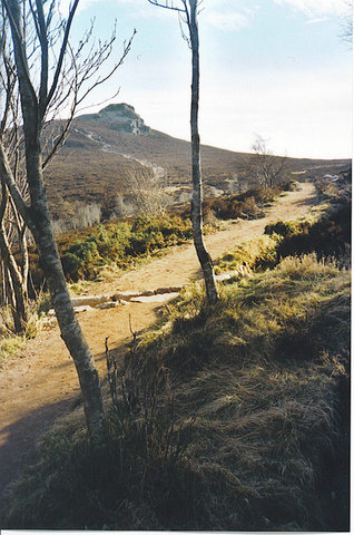
Maiden Causeway is a track averaging 3.5m wide reduced in places to a hollow way. Only for a length of about 60m immediately outside the entrance to the fort is there any definite sign of paving. Elsewhere this effect is created by the striated rock strata where the track has been weathered to bed rock. There is nothing to date it by, but several other tracks branch from it and it appears to be one of the main access roads to the Bennachie range and, as such, could be at least medieval if not an original route to the fort.
'The Maiden Causeway' is said to have run to Maiden Castle. 'One branch, seemingly the principal one, leaves the camp on the west side; another not quite so perfect leaves it on the east, and both meet at the foot of a small rock called the Nether Maiden (NJ 682 224). From this the road can be traced for a short distance when it disappears, or nearly so. It can again be distinctly traced where it crossed the head of Rushmill Burn (NJ 680 229) and from thence is very perfect until it joins the present road up the hill. From where it leaves this road at the top of Stay Knowe (NJ 685 235), and at this place is the most perfect portion, it is traceable to the woods of Pittodrie.
This prehistoric footpath leading up to the hillfort on the Mither Tap of Bennachie has an interesting story to its name. A girl is supposed to have accepted a marriage proposal on the proviso that, by the next morning, the suitor had built a road up Bennachie. The road was built - obviously by "Old Nick".
- All above information from RCAHMS.
The Mither Tap is generally assumed to be the Mons Grapius of Tacitus' description of Agricola's campaign into Scotland. If so, then Mither Tap is the site of a battle between 30,000 Caledonians under the leadership of Calgacus and the Roman legions of Agricola. The Caledonians, who held the hill initially, made an ill-fated decision to descend from the hill to meet the Romans in battle, thus opening themselves to attack from the Roman cavalry. According to Tacitus, the Caledonians lost some 10,000 men in the ensuing slaughter while Roman losses were contained at around 400.