Old Drove Road Show path on map
Start location: St Duthac's Way, north of Loch an Eang ( NH 248 239 )
End location: St Duthac's Way, southwest of Knockfin ( NH 292 260 )
Geographical area: Inverness, Nairn, Badenoch and Strathspey
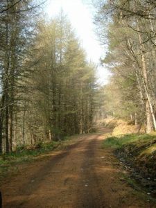
Path type: Drove Road
Path distance: 6.3km
Accessibility info: Suitable for pedestrians
Route Description
We have no recent survey of this path, but according to Ordnance Survey mapping it should be accessible as a combination of paths and fire roads. Any recent knowledge of the route would be very welcome indeed.
OS Landranger 25 (Glen Carron & surrounding area)
Heritage Information
This is a very short diversion that is thought to have been a route taken by drovers as an alternative to the main St Duthac's Way.
The reason drovers may have taken this route is not at all clear, but it may be that it has an easier gradient or more fresh water for the cattle. Another explanation could be that drovers took both routes rather than getting stuck in traffic jams.
