Old Track to Lochinver Show path on map
Start location: Lochinver ( NC 095 223 )
End location: A835 ( NC 230 122 )
Geographical area: Sutherland
Path type: Rural Path
Path distance: 20km
Accessibility info: Suitable for pedestrians
Route Description
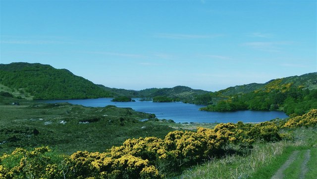
This is one of the best long distance walks in Assynt, taking a direct line through Glen Canisp between the splendid peaks of Suilven and Canisp, and following a good path for most of the way. Leave Lochinver by the private road to Glencanisp Lodge and continue along the road past the lodge and up Glen Canisp by a fine path past Suileag bothy (MBA), along the north side of Loch na Gainimh, and through the narrow defile of Ghlinne Dhorcha. Cross the burn at the outflow of Lochan Fada and climb gradually along the bare stony ridge on its south side. Less than 1km beyond the head of the loch, the path turns south along a low ridge and drops to Cam Loch. Finally follow the path southeast along the lochside to reach the A835, 2km from Elphin.
Heritage Information
This path appears on the 1st edition Ordnance Survey 6 inch to the mile map, first surveyed in the 1870s. It is also marked in John Home's Survey of Assynt in 1774 as Road from Inver to Ledbeg. In John Home's survey, a large number of shielings are marked, so at that time the route was likely used bi-annually by people at the shielings, in addition to people travelling between Lochinver and Ledmore or beyond. Assynt's interior was largely cleared of its local population for sheep in the early nineteenth century.
In the Old Statistical Account for the Parish of Assynt (1795), Reverend William Mackenzie refers to this route as Ed-ra-vine track, which he says “means, Betwixt two mountains, viz Sul-vine to the S and Ca-nisp to the N of this this track. Some have perished here, and severals have been in great danger of the like fate in time of winter storms”. He describes the way as almost equally bad as the disagreeable path from Inverkirkaig via Fionn Loch to Cam Loch, "though in part opened up several years past". He notes that there is but one habitation on this route, named Clo-ich-a-ry, situated in a contracted gloomy hollow, mostly surrounded by rocks, and occupied by a herd of Lieutenant Kenneth Mackenzie, the tacksman". There are the remains of various buildings and walls near where the Allt na Clach Airigh meets the Abhainn of the same name, and although this area is now bypassed using two bridges to cross and re-cross the river, on the OS 1" and 6" 1st editions the through route can be seen staying on the north bank, so it would seem reasonable to be certain this is the location of the aforesaid habitation.
Since 2005, this old route has crossed land owned by The Assynt Foundation, a community land-owning body which works with Woodland Trust Scotland on tree-planting and landscape restoration. In 2017-18, Coigach & Assynt Living Landscape partnership's Suilven Path project restored sections of path under the management of the John Muir Trust; CALL's website includes an excellent set of videos which are a testament to the achievement of the path workers.